Latitude: 51.1935 / 51°11'36"N
Longitude: 0.209 / 0°12'32"E
OS Eastings: 554452
OS Northings: 146130
OS Grid: TQ544461
Mapcode National: GBR MP3.5NB
Mapcode Global: VHHQ5.K8VD
Plus Code: 9F3256V5+CJ
Entry Name: Paul's Farmhouse
Listing Date: 10 September 1954
Grade: II*
Source: Historic England
Source ID: 1258824
English Heritage Legacy ID: 445255
ID on this website: 101258824
Location: Leigh, Sevenoaks, Kent, TN11
County: Kent
District: Sevenoaks
Civil Parish: Leigh
Built-Up Area: Leigh
Traditional County: Kent
Lieutenancy Area (Ceremonial County): Kent
Church of England Parish: Leigh
Church of England Diocese: Rochester
Tagged with: Farmhouse
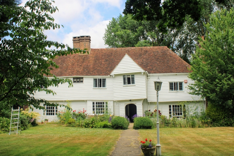
LEIGH LEIGH 1. 5280 Ensfield Road (West Side ) Paul's Farmhouse TQ 5446 19/656 10.9.54. II* 2. Timber framed house of C16 or earlier. 2 storeys, 4 windows, irregular. Hipped tiled roof with lower eaves along right return possibly older. Compound ridge stack near left end and external stack at right. Jettied 1st floor. Front covered in C18 weatherboarding. Back and sides of tile hanging and brick. 1st floor C18 leaded iron casements. Ground floor C18 tripartite sash windows. 2-storey projecting porch has oversailing gable end with pendants, early C17 appearance. Carved spandrels to Tudor-arched doorway. Roll moulding and hollow chamfer to frame of inner door. Inside, ground floor ceiling beams, joists and plates richly moulded. Main roof has side purlins and wind braces, very heavy, close-set rafters. One original wood-mullioned window. Earlier Eastern part may have been a hall. Part of roof renewed C18.
Listing NGR: TQ5445246130
External links are from the relevant listing authority and, where applicable, Wikidata. Wikidata IDs may be related buildings as well as this specific building. If you want to add or update a link, you will need to do so by editing the Wikidata entry.


Other nearby listed buildings