Latitude: 53.9598 / 53°57'35"N
Longitude: -1.08 / 1°4'47"W
OS Eastings: 460462
OS Northings: 451920
OS Grid: SE604519
Mapcode National: GBR NQWN.Z8
Mapcode Global: WHFC3.CQYP
Plus Code: 9C5WXW5C+W2
Entry Name: 1 and 2, Colliergate
Listing Date: 19 August 1971
Grade: II
Source: Historic England
Source ID: 1258035
English Heritage Legacy ID: 463175
ID on this website: 101258035
Location: York, North Yorkshire, YO1
County: York
Electoral Ward/Division: Guildhall
Parish: Non Civil Parish
Built-Up Area: York
Traditional County: Yorkshire
Lieutenancy Area (Ceremonial County): North Yorkshire
Church of England Parish: York All Saints, Pavement
Church of England Diocese: York
Tagged with: Building
YORK
SE6051NW COLLIERGATE 1112-1/28/223 (South West side) 19/08/71 Nos.1 AND 2
GV II
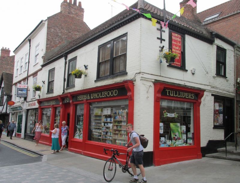
Shop. Late C19 with earlier origins. Painted brick with timber shopfront and modillion eaves cornice, returned at right end; pantile and tile roof with brick stack. EXTERIOR: 2-storey 3-window front. Shopfront of plain pilasters, frieze and moulded dentilled cornice on grooved brackets: plate glass windows over plain risers and three-quarter glazed door with blocked overlight. First floor windows are 4-pane sashes, paired at right end, with painted sills. Fluted rainwater head. Right return: 2 storeys, 2 windows. Shopfront returns to left of glazed door and 1-pane window beneath continuous lintel. First floor windows are 4-pane sashes with painted sills. INTERIOR: not inspected. (City of York: RCHME: The Central Area: HMSO: 1981-: 118).
Listing NGR: SE6046251920
External links are from the relevant listing authority and, where applicable, Wikidata. Wikidata IDs may be related buildings as well as this specific building. If you want to add or update a link, you will need to do so by editing the Wikidata entry.


Other nearby listed buildings