Latitude: 53.2638 / 53°15'49"N
Longitude: -1.9008 / 1°54'2"W
OS Eastings: 406714
OS Northings: 374088
OS Grid: SK067740
Mapcode National: GBR HZ5P.8R
Mapcode Global: WHBBS.S718
Plus Code: 9C5W737X+GM
Entry Name: Fairfield Vicarage
Listing Date: 15 May 1972
Grade: II
Source: Historic England
Source ID: 1257983
English Heritage Legacy ID: 463249
ID on this website: 101257983
Location: High Peak, Derbyshire, SK17
County: Derbyshire
District: High Peak
Electoral Ward/Division: Barms
Parish: Non Civil Parish
Built-Up Area: Buxton
Traditional County: Derbyshire
Lieutenancy Area (Ceremonial County): Derbyshire
Church of England Parish: Fairfield St Peter
Church of England Diocese: Derby
Tagged with: Clergy house
BUXTON
SK07SE ST PETER'S ROAD, Fairfield 616-1/2/96 (North East side) 15/05/72 Fairfield Vicarage
GV II
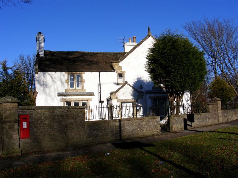
House, now vicarage. Possibly C17, late C18, altered late C19. Rendered and painted coursed rubble with ashlar dressings and stone slate roof with raised and moulded coped gables with kneelers and finials. 3 rendered stacks. EXTERIOR: 2 storey. Symmetrical 3-window front with flush gable to right. Projecting gabled porch has plank door, flanked by single 3-light mullion windows with plain sashes which project under lean-to roofs. Above a central small single plain sash flanked by 2-light mullion windows with plain sashes. Right return has 3 windows with slightly off-centre lean-to porch with C20 door. To left a 3-light mullion window with plain sashes which projects under lean-to roof, to right a 2-light window with plain sashes. Above single light window above door, flanked by 2-light mullion windows with plain sashes. All openings have painted ashlar surrounds. INTERIOR: retains encased beams with to main rooms, those to left of entrance seem to be of an earlier date.
Listing NGR: SK0671474088
External links are from the relevant listing authority and, where applicable, Wikidata. Wikidata IDs may be related buildings as well as this specific building. If you want to add or update a link, you will need to do so by editing the Wikidata entry.


Other nearby listed buildings