Latitude: 53.962 / 53°57'43"N
Longitude: -1.079 / 1°4'44"W
OS Eastings: 460521
OS Northings: 452165
OS Grid: SE605521
Mapcode National: GBR NQXM.5G
Mapcode Global: WHFC3.DNDZ
Plus Code: 9C5WXW6C+R9
Entry Name: 19, Goodramgate
Listing Date: 19 August 1971
Last Amended: 14 March 1997
Grade: II
Source: Historic England
Source ID: 1257764
English Heritage Legacy ID: 463490
ID on this website: 101257764
Location: York, North Yorkshire, YO1
County: York
Electoral Ward/Division: Guildhall
Parish: Non Civil Parish
Built-Up Area: York
Traditional County: Yorkshire
Lieutenancy Area (Ceremonial County): North Yorkshire
Church of England Parish: York St Michael-le-Belfrey
Church of England Diocese: York
Tagged with: Building
YORK
SE6052SE GOODRAMGATE 1112-1/14/390 (South East side) 19/08/71 No.19 (Formerly Listed as: GOODRAMGATE Nos.19 AND 21)
GV II
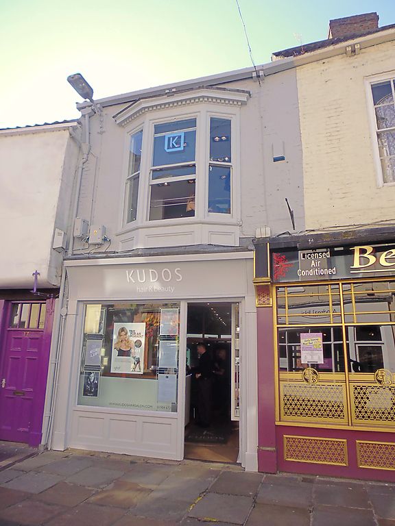
House. c1700 with mid C19 alteration and C20 shopfront. Front of painted brick in Flemish bond, rear of orange-brown brick in random bond, with timber shopfront; timber guttering on paired block brackets to pantile roof. EXTERIOR: 2-storey 1-window front. Shopfront has glazed door to right of plate glass window over sunk-panel riser, plain jambs and cornice, and coved fascia. First floor window is canted bay with 1-pane sashes and moulded and dentilled cornice. INTERIOR: not inspected.
Listing NGR: SE6052152165
External links are from the relevant listing authority and, where applicable, Wikidata. Wikidata IDs may be related buildings as well as this specific building. If you want to add or update a link, you will need to do so by editing the Wikidata entry.


Other nearby listed buildings