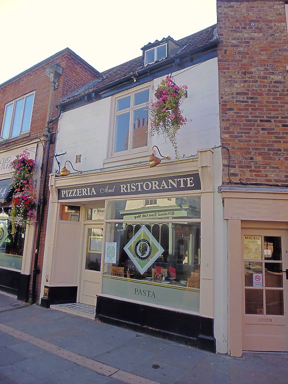
Latitude: 53.9619 / 53°57'42"N
Longitude: -1.0795 / 1°4'46"W
OS Eastings: 460492
OS Northings: 452145
OS Grid: SE604521
Mapcode National: GBR NQXM.2J
Mapcode Global: WHFC3.DP64
Plus Code: 9C5WXW6C+P6
Entry Name: 29, Goodramgate
Listing Date: 24 June 1983
Grade: II
Source: Historic England
Source ID: 1257730
English Heritage Legacy ID: 463498
ID on this website: 101257730
Location: York, North Yorkshire, YO1
County: York
Electoral Ward/Division: Guildhall
Parish: Non Civil Parish
Built-Up Area: York
Traditional County: Yorkshire
Lieutenancy Area (Ceremonial County): North Yorkshire
Church of England Parish: York St Michael-le-Belfrey
Church of England Diocese: York
Tagged with: Building
YORK
SE6052SW GOODRAMGATE 1112-1/27/397 (South East side) 24/06/83 No.29
GV II
House, now shop. Early C19 with earlier origins; late C19 extension and shopfront; C20 alteration. Original building timber-framed; present front of incised stucco with timber shopfront; eaves guttering on paired brackets and brick stacks to pantile roof. EXTERIOR: 2 storeys and attic; 1-window front. Shopfront, framed in pilasters and cornice, has glazed and panelled door and overlight recessed to left of half-canted plate glass window with transom. C20 cross window on first floor: attic has raking dormer with 2-light casement. INTERIOR: heavy quarter round moulded spine beam in shop. At rear of ground floor, partly blind 16-pane sash lights room formed from former yard, to which plank door with pegged-on frame gives access. Original wide floor boards said to survive in attic. Length of timber-framed partition wall visible on first floor of neighbouring Nos 31 and 33 (qv). (City of York: RCHME: The Central Area: HMSO: 1981-: 136).
Listing NGR: SE6049252145
External links are from the relevant listing authority and, where applicable, Wikidata. Wikidata IDs may be related buildings as well as this specific building. If you want to add or update a link, you will need to do so by editing the Wikidata entry.


Other nearby listed buildings