Latitude: 53.9536 / 53°57'12"N
Longitude: -1.0974 / 1°5'50"W
OS Eastings: 459326
OS Northings: 451208
OS Grid: SE593512
Mapcode National: GBR NQSQ.6H
Mapcode Global: WHFC3.3WPH
Plus Code: 9C5WXW33+C2
Entry Name: 77, Holgate Road
Listing Date: 19 August 1971
Last Amended: 14 March 1997
Grade: II
Source: Historic England
Source ID: 1257559
English Heritage Legacy ID: 463710
ID on this website: 101257559
Location: Holgate, York, North Yorkshire, YO24
County: York
Electoral Ward/Division: Micklegate
Parish: Non Civil Parish
Built-Up Area: York
Traditional County: Yorkshire
Lieutenancy Area (Ceremonial County): North Yorkshire
Church of England Parish: York St Paul
Church of England Diocese: York
Tagged with: Building
YORK
SE5951SW HOLGATE ROAD 1112-1/19/486 (South side) 19/08/71 No.77 (Formerly Listed as: HOLGATE ROAD Nos.71-77 (Odd))
GV II
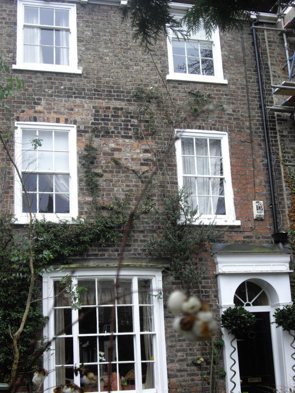
House. c1828-30. Brick with slate roof. EXTERIOR: 3 storeys, with the ground storey almost level with the semi-basement of No.75 (qv) 2 bays. On the ground floor there is a single tripartite slightly bowed glazing bar sash window. On the 1st and 2nd floors there are glazing bar sashes. The doorway, to the right, has a doorcase with engaged fluted columns, and with a frieze with a panel formed by a raised border. Above the door, which has 6 raised and fielded panels, there is a plain semicircular overlight. The gutter is carried on rectangular timber brackets. Shared chimneys to left and right. INTERIOR: not inspected. (RCHME: City of York: London: 1972-: 126).
Listing NGR: SE5932651208
External links are from the relevant listing authority and, where applicable, Wikidata. Wikidata IDs may be related buildings as well as this specific building. If you want to add or update a link, you will need to do so by editing the Wikidata entry.


Other nearby listed buildings