Latitude: 53.9485 / 53°56'54"N
Longitude: -1.0784 / 1°4'42"W
OS Eastings: 460582
OS Northings: 450661
OS Grid: SE605506
Mapcode National: GBR NQXS.B9
Mapcode Global: WHFC9.D0PT
Plus Code: 9C5WWWXC+CJ
Entry Name: Pikeing Well
Listing Date: 14 June 1954
Grade: II*
Source: Historic England
Source ID: 1257053
English Heritage Legacy ID: 464262
ID on this website: 101257053
Location: Clementhorpe, York, North Yorkshire, YO10
County: York
Electoral Ward/Division: Fishergate
Parish: Non Civil Parish
Built-Up Area: York
Traditional County: Yorkshire
Lieutenancy Area (Ceremonial County): North Yorkshire
Church of England Parish: Fulford St Oswald
Church of England Diocese: York
Tagged with: Well
YORK
SE6050NE NEW WALK 1112-1/25/800 (East side) 14/06/54 Pikeing Well
II*
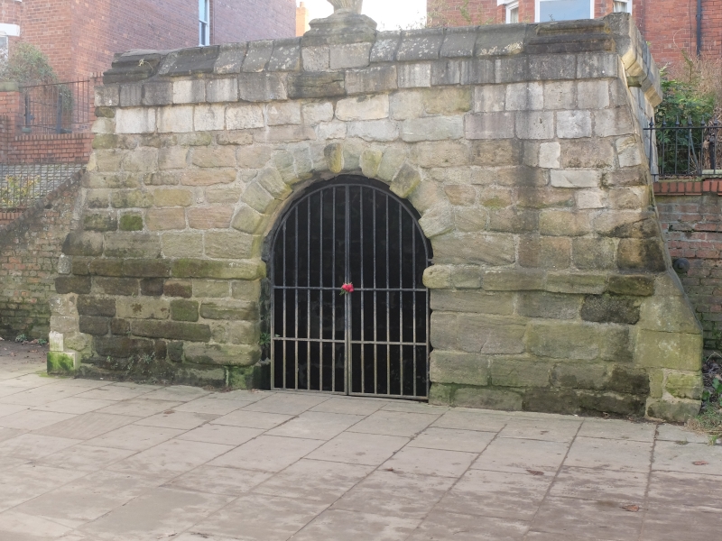
Formerly known as: The Well House NEW WALK. Wellhead building. 1752. By John Carr, re-using some earlier stonework. Squared limestone blocks with some re-used sandstone pilaster bases. Asphalt roof. PLAN: rectangular, with battered side walls and with a semicircular projection at the rear. EXTERIOR: west wall, facing the river, has an archway with semicircular head, worn voussoirs, and an impost band. It now has C20 iron gates. The parapet has saddlebacked coping stones, and 3 re-used moulded pilaster bases. The central one is surmounted by a broken C12 capital re-used as a finial. INTERIOR: stone vaulted barrel roof, with semicircular niche in rear wall. HISTORICAL NOTE: New Walk was laid out as a fashionable promenade between 1730-39, the wellhead being commissioned by the City Corporation to provide an interesting feature. The legend that stone from the chancel of All Saints Church, Pavement (qv), was re-used in the well is unfounded, since the chancel of the church was not demolished until 1782. Part of the fee paid to Carr for the well was retained by the City Corporation as payment for his Freedom of the City. (Bartholomew City Guides: Hutchinson J and Palliser DM: York: Edinburgh: 1980-: 210; An Inventory of the Historical Monuments of the City of York: RCHME: Outside the City Walls East of the Ouse: HMSO: 1975-: 53; The Works in Architecture of John Carr: York: 1973-).
Listing NGR: SE6062550778
External links are from the relevant listing authority and, where applicable, Wikidata. Wikidata IDs may be related buildings as well as this specific building. If you want to add or update a link, you will need to do so by editing the Wikidata entry.


Other nearby listed buildings