Latitude: 53.9529 / 53°57'10"N
Longitude: -1.0927 / 1°5'33"W
OS Eastings: 459638
OS Northings: 451141
OS Grid: SE596511
Mapcode National: GBR NQTQ.7Q
Mapcode Global: WHFC3.5WXZ
Plus Code: 9C5WXW34+5W
Entry Name: Number 17 and Attached Railings
Listing Date: 24 June 1983
Grade: II
Source: Historic England
Source ID: 1257021
English Heritage Legacy ID: 464318
ID on this website: 101257021
Location: Clementhorpe, York, North Yorkshire, YO24
County: York
Electoral Ward/Division: Micklegate
Parish: Non Civil Parish
Built-Up Area: York
Traditional County: Yorkshire
Lieutenancy Area (Ceremonial County): North Yorkshire
Church of England Parish: Micklegate Holy Trinity
Church of England Diocese: York
Tagged with: Building
YORK
SE5951SE PARK STREET 1112-1/20/827 (North East side) 24/06/83 No.17 and attached railings
GV II
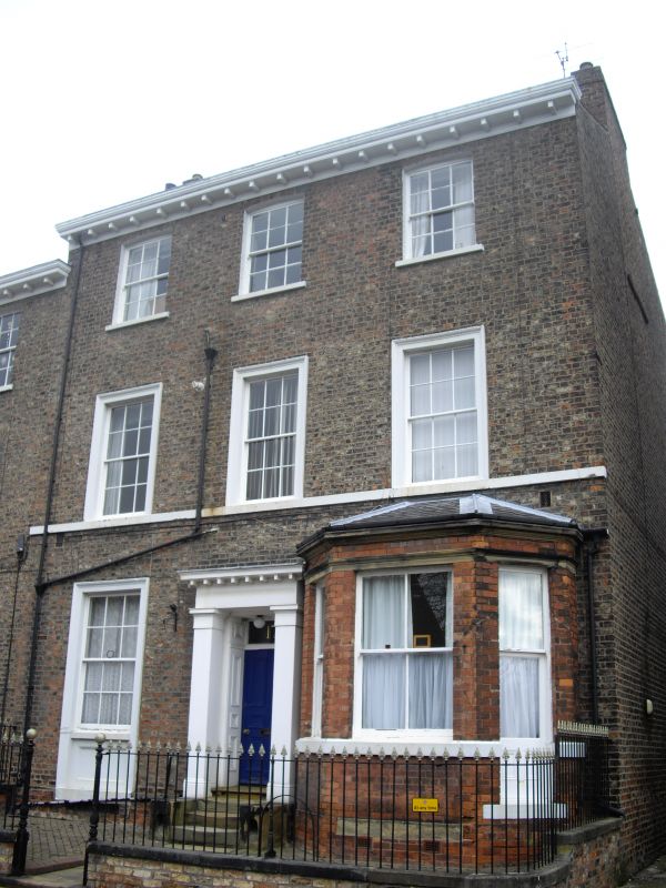
House. c1847-50 with late C19 alterations. Brick with painted stone dressings. Slate roof. EXTERIOR: 3 storeys and 3 bays. The right-hand bay contains a single-storey late C19 brick canted bay window with slate roof. It is sashed, except for the right-hand light which has had its sill lowered to accommodate a door. The other windows are glazing bar sashes. The left-hand window on the ground floor has an architrave with apron. The 1st floor windows have architraves and a sill band, and the 2nd floor windows have segmental brick heads. The central doorway has a pilaster doorcase with modillion cornice, panelled reveals, and a 6-panel door with overlight. The cornice gutter is supported on timber brackets. Chimneys to left and right. INTERIOR: not inspected. SUBSIDIARY FEATURES: attached to right corner a low brick wall with ashlar coping and cast-iron railings, which enclose front garden with central gateway unit with 2 iron gateposts with ball finials. (An Inventory of the Historical Monuments of the City of York: RCHME: South-west of the Ouse: HMSO: 1972-: 129).
Listing NGR: SE5963851141
External links are from the relevant listing authority and, where applicable, Wikidata. Wikidata IDs may be related buildings as well as this specific building. If you want to add or update a link, you will need to do so by editing the Wikidata entry.


Other nearby listed buildings