Latitude: 53.9609 / 53°57'39"N
Longitude: -1.0835 / 1°5'0"W
OS Eastings: 460233
OS Northings: 452039
OS Grid: SE602520
Mapcode National: GBR NQWM.7V
Mapcode Global: WHFC3.BP9V
Plus Code: 9C5WXW68+9J
Entry Name: 32, Stonegate
Listing Date: 1 July 1968
Grade: II
Source: Historic England
Source ID: 1256521
English Heritage Legacy ID: 464826
ID on this website: 101256521
Location: York, North Yorkshire, YO1
County: York
Electoral Ward/Division: Guildhall
Parish: Non Civil Parish
Built-Up Area: York
Traditional County: Yorkshire
Lieutenancy Area (Ceremonial County): North Yorkshire
Church of England Parish: York St Michael-le-Belfrey
Church of England Diocese: York
Tagged with: Building
YORK
SE6052SW STONEGATE 1112-1/27/1027 (North West side) 01/07/68 No.32
GV II
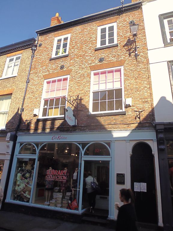
House, now shop. Early C19, altered and extended at rear in late C19; renovated with new shop window in late C20. Orange-grey brick in Flemish bond; timber cornice; brick stacks to pantile roof. EXTERIOR: 3-storey 2-window front. Shopfront of 3 arcaded plate glass lights incorporating door at right end and round passage arch on shaped imposts further right. First floor has 16-pane sashes, second floor 6-pane casement windows, all with painted sills and flat arches of orange gauged brick. Moulded and modillioned eaves cornice. INTERIOR: cantilevered dogleg staircase has lower flights of stone treads with concave undersides: upper flights are wooden. Cast-iron balusters are square section, hollow sided on lower flights; handrail ramped up and wreathed at foot on shaped curtail step. In first floor front room, hemi-domed niches flank chimney breast. (City of York: RCHME: The Central Area: HMSO: 1981-: 222).
Listing NGR: SE6023052042
External links are from the relevant listing authority and, where applicable, Wikidata. Wikidata IDs may be related buildings as well as this specific building. If you want to add or update a link, you will need to do so by editing the Wikidata entry.


Other nearby listed buildings