Latitude: 53.9529 / 53°57'10"N
Longitude: -1.0959 / 1°5'45"W
OS Eastings: 459427
OS Northings: 451129
OS Grid: SE594511
Mapcode National: GBR NQSQ.JR
Mapcode Global: WHFC3.4XD1
Plus Code: 9C5WXW33+4J
Entry Name: 128, the Mount
Listing Date: 10 September 1970
Last Amended: 14 March 1997
Grade: II
Source: Historic England
Source ID: 1256427
English Heritage Legacy ID: 464914
ID on this website: 101256427
Location: Clementhorpe, York, North Yorkshire, YO24
County: York
Electoral Ward/Division: Micklegate
Parish: Non Civil Parish
Built-Up Area: York
Traditional County: Yorkshire
Lieutenancy Area (Ceremonial County): North Yorkshire
Church of England Parish: York St Paul
Church of England Diocese: York
Tagged with: Building
YORK
SE5951SW THE MOUNT 1112-1/19/1094 (North West side) 10/09/70 No.128 (Formerly Listed as: THE MOUNT Nos.116-134 (Even))
GV II
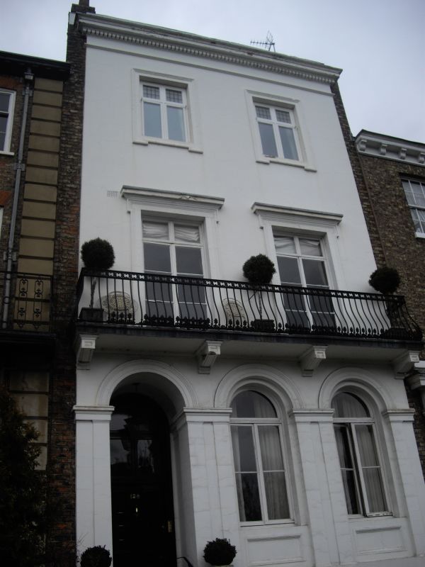
House. c1840. Stucco with brick gable walls and chimneys. EXTERIOR: 3 storeys above cellar. 2 bays. The windows are cross casements. The ground-floor windows have semicircular heads and are recessed within moulded semicircular arches with moulded imposts which form the capitals to pilaster reveals. Below the sills there are panelled aprons. The 1st floor windows have cornices and lugged architraves, and open onto a stone balcony carried on brackets, with cast-iron railings. The 2nd floor windows have architraves. The doorway, at the left, is recessed into an arched opening similar to the 2 window arches to its right. The door has 4 panels, and an altered window above. The 2 cellar window openings have segmental arches. Dentilled gutter cornice below blocking course. Narrow strips of brickwork party wall are visible to left and right. Chimneys in front of ridge at left and on ridge at right. INTERIOR: not inspected. (An Inventory of the Historical Monuments of the City of York: RCHME: South-west of the Ouse: HMSO: 1972-: 128).
Listing NGR: SE5942751129
External links are from the relevant listing authority and, where applicable, Wikidata. Wikidata IDs may be related buildings as well as this specific building. If you want to add or update a link, you will need to do so by editing the Wikidata entry.


Other nearby listed buildings