Latitude: 53.9511 / 53°57'3"N
Longitude: -1.097 / 1°5'49"W
OS Eastings: 459356
OS Northings: 450931
OS Grid: SE593509
Mapcode National: GBR NQSR.9D
Mapcode Global: WHFC3.3YWD
Plus Code: 9C5WXW23+C5
Entry Name: 127, the Mount
Listing Date: 21 April 1983
Grade: II
Source: Historic England
Source ID: 1256426
English Heritage Legacy ID: 464913
ID on this website: 101256426
Location: South Bank, York, North Yorkshire, YO24
County: York
Electoral Ward/Division: Micklegate
Parish: Non Civil Parish
Built-Up Area: York
Traditional County: Yorkshire
Lieutenancy Area (Ceremonial County): North Yorkshire
Church of England Parish: Micklegate Holy Trinity
Church of England Diocese: York
Tagged with: Building
YORK
SE5950NW THE MOUNT 1112-1/24/1093 (South East side) 21/04/83 No.127
GV II
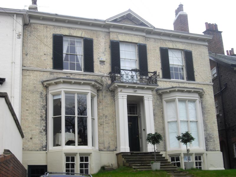
House. 1833; altered c1930; restored 1992. Yellow brick with painted stone dressings. Hipped slate roof. EXTERIOR: 2 storeys above cellars and 3 bays, with the central bay projecting slightly. The outer bays have single-storey canted bay windows which have bracketed cornices and sashes without glazing bars. The base of the left-hand window is partly cut into by an inserted C20 cellar doorway. The 1st floor windows are glazing bar sashes with rubbed brick flat arches and a sill band. The timber porch has paired pilasters, and a modillioned cornice which forms the base of a balcony. This has cast-iron railings with anthemion decoration. The inner door has panelled reveals, and an overlight with margin panes. The eaves cornice is modillioned and includes a triangular pediment above the central bay. Chimneys to left and right. INTERIOR: cellars: room at front left, formerly converted to garage, has wooden car turntable in situ. Ground floor: staircase to first floor has slender turned balusters and moulded handrail wreathed at foot around shaped curtail step. Original plaster work survives in all the main rooms. On first floor and attics some original fireplaces survive. (An Inventory of the Historical Monuments of the City of York: RCHME: South-west of the Ouse: HMSO: 1972-: 127; ).
Listing NGR: SE5935650931
External links are from the relevant listing authority and, where applicable, Wikidata. Wikidata IDs may be related buildings as well as this specific building. If you want to add or update a link, you will need to do so by editing the Wikidata entry.


Other nearby listed buildings