Latitude: 53.9573 / 53°57'26"N
Longitude: -1.0775 / 1°4'38"W
OS Eastings: 460629
OS Northings: 451637
OS Grid: SE606516
Mapcode National: GBR NQXP.J5
Mapcode Global: WHFC3.FS4N
Plus Code: 9C5WXW4F+W2
Entry Name: 11 and 11A, Walmgate
Listing Date: 24 June 1983
Last Amended: 14 March 1997
Grade: II
Source: Historic England
Source ID: 1256364
English Heritage Legacy ID: 464984
ID on this website: 101256364
Location: Foss Islands, York, North Yorkshire, YO1
County: York
Electoral Ward/Division: Guildhall
Parish: Non Civil Parish
Built-Up Area: York
Traditional County: Yorkshire
Lieutenancy Area (Ceremonial County): North Yorkshire
Church of England Parish: York St Denys
Church of England Diocese: York
Tagged with: Building
YORK
SE6051NE WALMGATE 1112-1/17/1152 (South West side) 24/06/83 Nos.11 AND 11A (Formerly Listed as: WALMGATE No.11)
GV II
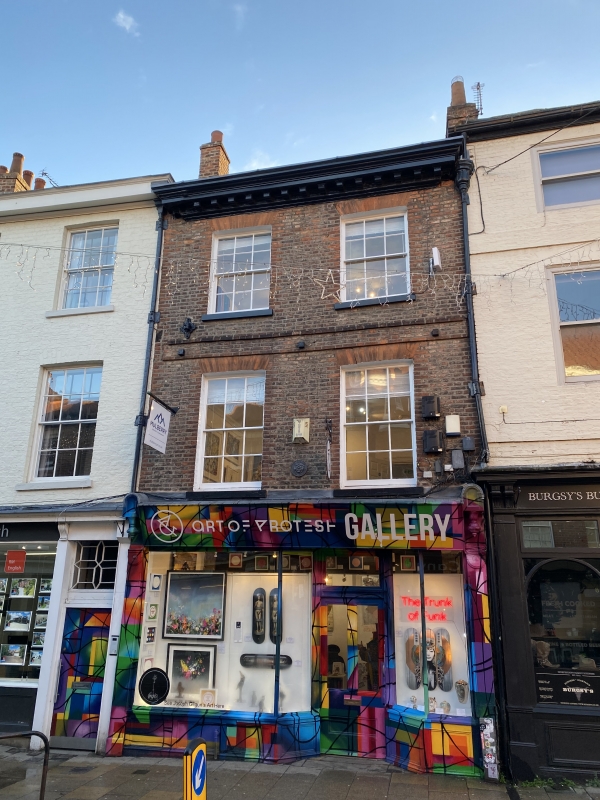
House with shop. Mid C18, altered c1840; late C19 shopfront. Buff brick, front in Flemish bond, rear in English garden-wall bond; heavy eaves cornice with modillions and shopfront of timber; slate roof, hipped at front, gabled at rear. EXTERIOR: 3-storey 2-window front. Shopfront of plain pilasters beneath pent fascia between carved terminal blocks with carved pendant finials: off-centre glazed and panelled door with overlight recessed between half-canted plate glass windows over sunk panel risers. First and second floor windows are 12-pane sashes, taller on first floor, with stone sills and flat arches of orange brick. Second floor band. INTERIOR: not inspected. (City of York: RCHME: The Central Area: HMSO: 1981-: 239).
Listing NGR: SE6062951637
External links are from the relevant listing authority and, where applicable, Wikidata. Wikidata IDs may be related buildings as well as this specific building. If you want to add or update a link, you will need to do so by editing the Wikidata entry.


Other nearby listed buildings