Latitude: 52.2273 / 52°13'38"N
Longitude: -2.7381 / 2°44'17"W
OS Eastings: 349678
OS Northings: 259044
OS Grid: SO496590
Mapcode National: GBR FK.1TNW
Mapcode Global: VH84W.H89X
Plus Code: 9C4V67G6+WP
Entry Name: 27, Drapers Lane
Listing Date: 9 July 1976
Grade: II
Source: Historic England
Source ID: 1255433
English Heritage Legacy ID: 459684
ID on this website: 101255433
Location: Leominster, County of Herefordshire, HR6
County: County of Herefordshire
Civil Parish: Leominster
Built-Up Area: Leominster
Traditional County: Herefordshire
Lieutenancy Area (Ceremonial County): Herefordshire
Church of England Parish: Leominster
Church of England Diocese: Hereford
Tagged with: Building
LEOMINSTER
SO4959 DRAPERS LANE 808-1/1/118 (East side) 09/07/76 No.27
GV II
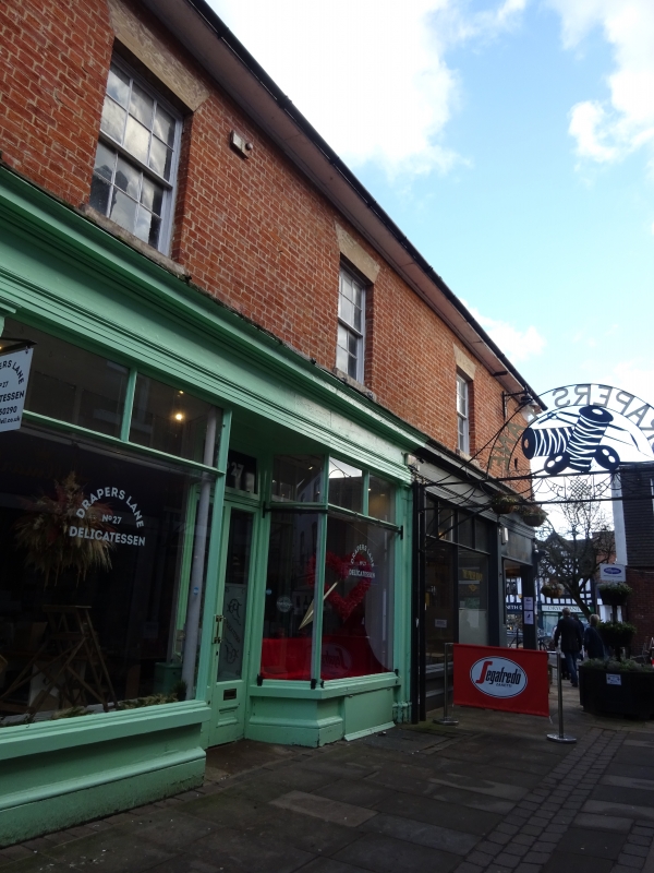
Shop and dwelling. Early C19, with later alterations. Red brick; slate roof. 2 storeys and cellar; 3-window range: 6/6 sashes under stucco flat arches; boarded eaves. To left, late C19 shop front with central etched glass double doors and plain overlight under panelled soffit, between canted plate-glass windows with moulded glazing bars and clerestory lights; to right, similar shop-window; double doors with etched glass and plain sashes, recessed under canted return; moulded fascia-board and hood overall. Right returned side: three 6/6 sashes under stucco flat arches and late C19 light with spandrel glazing under flat hood; four 3/3 sashes under stucco flat arches, over; returned shop front; canted C20 shop-window, and carriageway to rear, with moulded fascia-board over. Carriageway has late C19 part-glazed 6-panel door and overlight with glazing bars. INTERIOR not inspected.
Listing NGR: SO4967859044
External links are from the relevant listing authority and, where applicable, Wikidata. Wikidata IDs may be related buildings as well as this specific building. If you want to add or update a link, you will need to do so by editing the Wikidata entry.


Other nearby listed buildings