Latitude: 52.7068 / 52°42'24"N
Longitude: -2.7522 / 2°45'7"W
OS Eastings: 349276
OS Northings: 312394
OS Grid: SJ492123
Mapcode National: GBR BJ.2H45
Mapcode Global: WH8BT.P7N6
Plus Code: 9C4VP64X+P4
Entry Name: 85 and 86, Wyle Cop
Listing Date: 10 January 1953
Grade: II
Source: Historic England
Source ID: 1255126
English Heritage Legacy ID: 458763
ID on this website: 101255126
Location: Shrewsbury, Shropshire, SY1
County: Shropshire
Civil Parish: Shrewsbury
Built-Up Area: Shrewsbury
Traditional County: Shropshire
Lieutenancy Area (Ceremonial County): Shropshire
Church of England Parish: Shrewsbury St Chad
Church of England Diocese: Lichfield
Tagged with: Building
SHREWSBURY
SJ4912SW WYLE COP 653-1/15/737 (South side) 10/01/53 Nos.85 AND 86
GV II
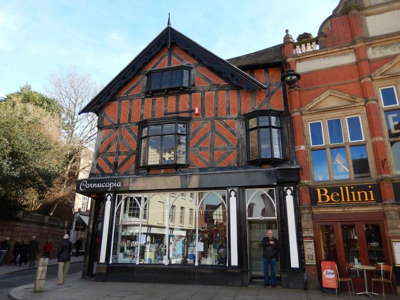
Formerly known as: No.85 WYLE COP. Shop, originally dwelling. Late C16 and c1640 with late C19 alterations. Timber-framed with later brick nogging and plain tiled roof. Decorative framing with lozenge pattern in square panels, and close studded band above first floor. 2 storeys, with attic added c1640, two-window range. Late C19 shop front with continuous windows with traceried glazing each side of central traceried door, and on return elevation to Milk Street. Additional door across angle. Continuous plain fascia across both facades. Upper windows are oriel bays with transoms and leaded lights. 2 gabled dormers break the eaves, with elaborate fretted barge-boards with finials. Small oriel window in gable to Milk Street. Partial rear wing to Milk Street. (Smith JT: Shrewsbury: Topography and Domestic Architecture to the mid C17: 1953-).
Listing NGR: SJ4927612394
External links are from the relevant listing authority and, where applicable, Wikidata. Wikidata IDs may be related buildings as well as this specific building. If you want to add or update a link, you will need to do so by editing the Wikidata entry.


Other nearby listed buildings