Latitude: 52.691 / 52°41'27"N
Longitude: -2.7633 / 2°45'47"W
OS Eastings: 348505
OS Northings: 310637
OS Grid: SJ485106
Mapcode National: GBR BJ.3DDY
Mapcode Global: WH8BT.JMCD
Plus Code: 9C4VM6RP+9M
Entry Name: Vicarage Cottages
Listing Date: 26 June 1972
Last Amended: 17 November 1995
Grade: II
Source: Historic England
Source ID: 1255085
English Heritage Legacy ID: 458391
ID on this website: 101255085
Location: Meole Brace, Shropshire, SY3
County: Shropshire
Civil Parish: Shrewsbury
Built-Up Area: Shrewsbury
Traditional County: Shropshire
Lieutenancy Area (Ceremonial County): Shropshire
Church of England Parish: Meole Brace Holy Trinity
Church of England Diocese: Lichfield
Tagged with: Cottage
SHREWSBURY
SJ41SE VICARAGE ROAD, Meole Brace 653-1/4/765 (East side) 26/06/72 Vicarage Cottages (Formerly Listed as: VICARAGE ROAD, Meole Brace Nos.1 and 2 Vicarage Cottages)
GV II
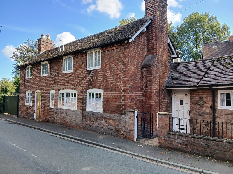
Pair of cottages. Late C18. Brick with plain tiled roof. Low 2 storeys, 5-window range with blind window in centre. Probably each a single-unit plan originally, though the plans modified in subsequent alterations. Left-hand house has 2-light casement window with single ring cambered head to left of doorway, and two 2-light casement windows above. To the right, inserted horizontally sliding sash cuts the segmental head of an earlier opening. Right-hand house entered via single-storey wing added to gable return. Gable end stacks.
Listing NGR: SJ4850510637
External links are from the relevant listing authority and, where applicable, Wikidata. Wikidata IDs may be related buildings as well as this specific building. If you want to add or update a link, you will need to do so by editing the Wikidata entry.


Other nearby listed buildings