Latitude: 53.4343 / 53°26'3"N
Longitude: -2.2282 / 2°13'41"W
OS Eastings: 384938
OS Northings: 393086
OS Grid: SJ849930
Mapcode National: GBR DXWQ.DL
Mapcode Global: WHB9N.RY51
Plus Code: 9C5VCQMC+PP
Entry Name: 456, Wilmslow Road
Listing Date: 6 June 1994
Grade: II
Source: Historic England
Source ID: 1255025
English Heritage Legacy ID: 458607
ID on this website: 101255025
Location: Withington, Manchester, Greater Manchester, M20
County: Manchester
Electoral Ward/Division: Withington
Parish: Non Civil Parish
Built-Up Area: Manchester
Traditional County: Lancashire
Lieutenancy Area (Ceremonial County): Greater Manchester
Church of England Parish: Withington St Paul
Church of England Diocese: Manchester
Tagged with: Building
This list entry was subject to a Minor Amendment on 14 January 2026 to update the Name and Address and reformat the text to current standards
SJ89SW
698-1/8/846
MANCHESTER
Withington
WILMSLOW ROAD (West side)
No.456
(Formerly listed as No.456 Pampers)
GV
II
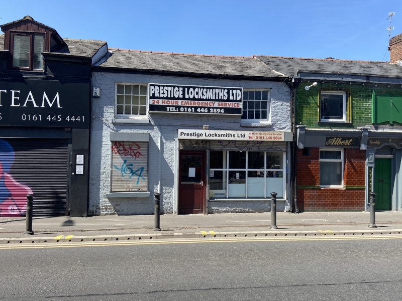
Small house or shop, now shop. Early C19, altered. Brick painted white with dressings painted black, graduated slate roof. Double-depth double-fronted plan. Two low storeys with two windows at first floor; central doorway with shop window of eight large panes to the right all under C20 canopy; sashed window to left (eight panes in upper leaf but lower leaf now lacking glazing bars); large C20 signboard in centre of first floor flanked by square 12-pane sashed windows (four panes in the upper leaf and eight in the lower), all these sashed windows with deep splayed heads of gauged brick. Now no chimneys.
Listing NGR: SJ8493893086
External links are from the relevant listing authority and, where applicable, Wikidata. Wikidata IDs may be related buildings as well as this specific building. If you want to add or update a link, you will need to do so by editing the Wikidata entry.


Other nearby listed buildings