Latitude: 52.7062 / 52°42'22"N
Longitude: -2.7616 / 2°45'41"W
OS Eastings: 348639
OS Northings: 312330
OS Grid: SJ486123
Mapcode National: GBR BJ.2LS4
Mapcode Global: WH8BT.K75P
Plus Code: 9C4VP64Q+F9
Entry Name: Bandstand
Listing Date: 19 September 1972
Last Amended: 17 November 1995
Grade: II
Source: Historic England
Source ID: 1255022
English Heritage Legacy ID: 458351
ID on this website: 101255022
Location: The Quarry, Kingsland, Shropshire, SY1
County: Shropshire
Civil Parish: Shrewsbury
Built-Up Area: Shrewsbury
Traditional County: Shropshire
Lieutenancy Area (Ceremonial County): Shropshire
Church of England Parish: Shrewsbury St Chad
Church of England Diocese: Lichfield
Tagged with: Bandstand
SHREWSBURY
SJ4812SE THE QUARRY 653-1/14/650 Bandstand 19/09/72 (Formerly Listed as: THE QUARRY (OR THE DINGLE) Bandstand)
GV II
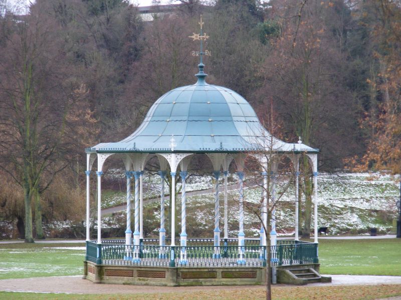
Bandstand. Dated 1879. Cast by McDowell Steven and Co of Glasgow. Cast-iron columns, wrought-iron roof on stone base with vermiculated blocks. Circular base and octagonal canopy. Cast-iron railings and gates to platform. Columns cast with low relief decorative panels on bases, delicate capitals and elaborate spandrel decoration carrying bell cast octagonal canopy ribbed and with scallopped eaves cornice capped by weather vane. Inner ring of columns has superimposed spirals, elongated capitals and ornate spandrel decoration.
Listing NGR: SJ4881412192
External links are from the relevant listing authority and, where applicable, Wikidata. Wikidata IDs may be related buildings as well as this specific building. If you want to add or update a link, you will need to do so by editing the Wikidata entry.


Other nearby listed buildings