Latitude: 52.7021 / 52°42'7"N
Longitude: -2.7317 / 2°43'54"W
OS Eastings: 350651
OS Northings: 311854
OS Grid: SJ506118
Mapcode National: GBR BK.2VHV
Mapcode Global: WH8BV.0BGV
Plus Code: 9C4VP729+R8
Entry Name: Brooklands
Listing Date: 19 September 1972
Last Amended: 17 November 1995
Grade: II
Source: Historic England
Source ID: 1254937
English Heritage Legacy ID: 458396
ID on this website: 101254937
Location: Cherry Orchard, Shropshire, SY2
County: Shropshire
Civil Parish: Shrewsbury
Built-Up Area: Shrewsbury
Traditional County: Shropshire
Lieutenancy Area (Ceremonial County): Shropshire
Church of England Parish: Shrewsbury St Giles with Sutton
Church of England Diocese: Lichfield
Tagged with: Building
SHREWSBURY
SJ51SW WENLOCK ROAD 653-1/5/690 (West side) 19/09/72 No.20 Brooklands (Formerly Listed as: WENLOCK ROAD Brooklands)
II
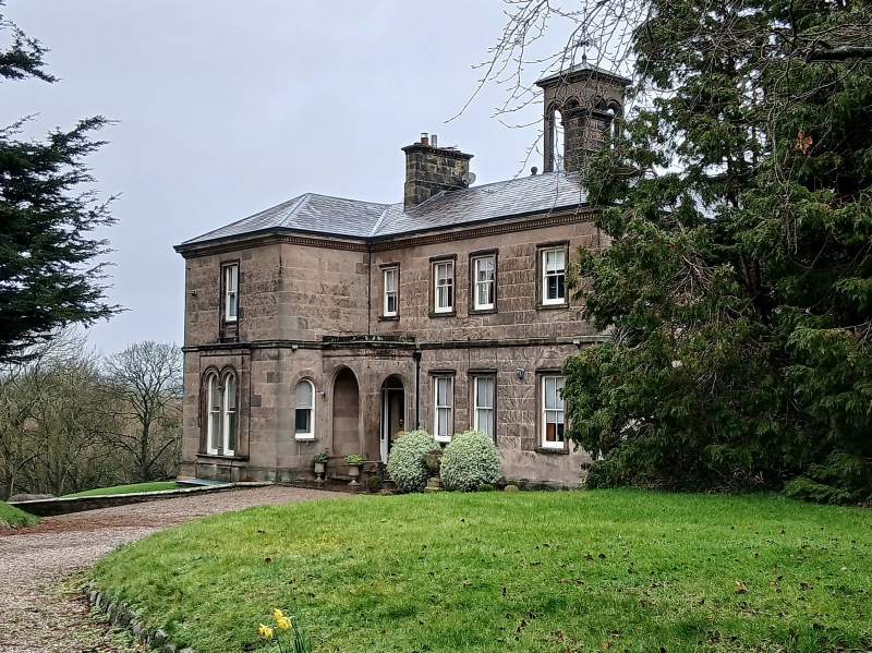
House. c1850. Ashlar-faced with Welsh slate roof. Italianate style. 2 storeys, 4-window range, square in plan, with projecting gabled wing to left of entrance front. Doorway in angle of this gable, with round-arched porch and paired 4-pane sash windows to right. 4 upper windows also 4-pane sashes, the central 2 paired. Paired round-arched sash windows divided by a shaft, advanced in ground floor of gable. All windows have stressed architraves. Pedimented windows in return elevation to rear. Canted bay windows in garden front. Central belvedere with arcading, and shallow pyramidal roof with weather vane. Axial stacks.
Listing NGR: SJ5065111854
External links are from the relevant listing authority and, where applicable, Wikidata. Wikidata IDs may be related buildings as well as this specific building. If you want to add or update a link, you will need to do so by editing the Wikidata entry.


Other nearby listed buildings