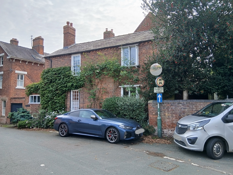
Latitude: 52.6915 / 52°41'29"N
Longitude: -2.7591 / 2°45'32"W
OS Eastings: 348791
OS Northings: 310695
OS Grid: SJ487106
Mapcode National: GBR BJ.3FFV
Mapcode Global: WH8BT.LLCZ
Plus Code: 9C4VM6RR+J9
Entry Name: Meole Cottage
Listing Date: 20 September 1994
Last Amended: 17 November 1995
Grade: II
Source: Historic England
Source ID: 1254669
English Heritage Legacy ID: 457690
ID on this website: 101254669
Location: Meole Brace, Shropshire, SY3
County: Shropshire
Civil Parish: Shrewsbury
Built-Up Area: Shrewsbury
Traditional County: Shropshire
Lieutenancy Area (Ceremonial County): Shropshire
Church of England Parish: Meole Brace Holy Trinity
Church of England Diocese: Lichfield
Tagged with: Cottage
SHREWSBURY
SJ41SE MILL ROAD, Meole Brace 653-1/4/759 (South side) 20/09/94 Meole Cottage (Formerly Listed as: CHURCH ROAD, Meole Brace (East side) Meole Cottage)
GV II
House, possibly originally mid C18 with later additions. Brick with Welsh slate and plain tiled roofs. C18 building forms long range with gable facing street with C19 bow window to ground floor, renewed sash above; the C19 rear coped gable containing a late C18 full-height bow with 12-pane sash windows with flat-arched stuccoed heads with stressed voussoirs. Late C18 wing added to right, at right angles to original block, the fenestration renewed. Entrances now in side wall and in later wing. Side wall stack to C19 addition.
Listing NGR: SJ4879110695
External links are from the relevant listing authority and, where applicable, Wikidata. Wikidata IDs may be related buildings as well as this specific building. If you want to add or update a link, you will need to do so by editing the Wikidata entry.


Other nearby listed buildings