Latitude: 52.951 / 52°57'3"N
Longitude: -1.1441 / 1°8'38"W
OS Eastings: 457599
OS Northings: 339633
OS Grid: SK575396
Mapcode National: GBR LQQ.F9
Mapcode Global: WHDGZ.D3D0
Plus Code: 9C4WXV24+98
Entry Name: County Tavern
Listing Date: 12 July 1972
Last Amended: 30 November 1995
Grade: II
Source: Historic England
Source ID: 1254503
English Heritage Legacy ID: 457240
Also known as: Cock and Hoop, Nottingham
Cock & Hoop, Nottingham
Cock & Hoop
27, High Pavement
27, High Pavement, Nottingham
25, High Pavement
25, High Pavement, Nottingham
ID on this website: 101254503
Location: Lace Market, Nottingham, Nottinghamshire, NG1
County: City of Nottingham
Electoral Ward/Division: Bridge
Parish: Non Civil Parish
Built-Up Area: Nottingham
Traditional County: Nottinghamshire
Lieutenancy Area (Ceremonial County): Nottinghamshire
Church of England Parish: Nottingham St Peter with St James
Church of England Diocese: Southwell and Nottingham
NOTTINGHAM
SK5739NE HIGH PAVEMENT 646-1/21/261 (North side) 12/07/72 No.27 County Tavern (Formerly Listed as: HIGH PAVEMENT No.27)
GV II
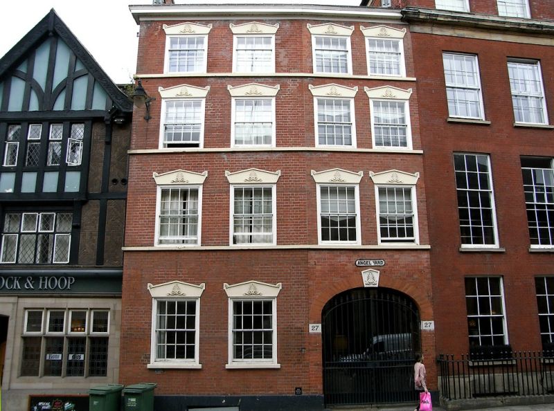
House, now public house. Early and mid C19. Brick with painted ashlar dressings and slate roof with a gable stack. Plinth, sill bands to each floor, deep wooden eaves. 4 storeys; 4 window range of 16-pane sashes arranged 2:2. On the third floor, 12-pane sashes. All the windows have sarcophagus-shaped lintels. Ground floor has to right an elliptical arched carriage entrance with shaped keystone and a pair of cast-iron gates. To left, 2 windows.
Listing NGR: SK5759939633
External links are from the relevant listing authority and, where applicable, Wikidata. Wikidata IDs may be related buildings as well as this specific building. If you want to add or update a link, you will need to do so by editing the Wikidata entry.


Other nearby listed buildings