Latitude: 53.905 / 53°54'18"N
Longitude: -1.6019 / 1°36'6"W
OS Eastings: 426252
OS Northings: 445505
OS Grid: SE262455
Mapcode National: GBR KR78.ZW
Mapcode Global: WHC8Z.C3FN
Plus Code: 9C5WW94X+26
Entry Name: Wharfedale Viaduct
Listing Date: 7 April 1988
Grade: II
Source: Historic England
Source ID: 1253368
English Heritage Legacy ID: 436536
ID on this website: 101253368
Location: Castley, Leeds, West Yorkshire, LS21
County: Leeds
Civil Parish: Arthington
Traditional County: Yorkshire
Lieutenancy Area (Ceremonial County): West Yorkshire
Church of England Parish: Pool and Arthington
Church of England Diocese: Leeds
SE 24 NE
2/92
ARTHINGTON
WARREN LANE LS 21
Wharfedale Viaduct
II
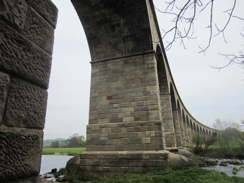
Railway Viaduct, carrying Leeds to Thirsk Railway over River Wharfe.
1845 to 1849; Engineer, Thomas Grainger. Punched sandstone blocks. Twenty
semicircular arches carried on very high rectangular piers, following a line
curving towards the north-east; the piers have rounded-nose cutwaters,
roll-moulded bands carried round at the springing of the arches; the arches
have rusticated stepped voussoirs; there are large roll-moulded string
courses and coped parapets each side; and 5 circular tie plates to the
1st arch and 7 to the 4th arch. Also known as Castley Viaduct.
Note: only the 6 southernmost arches are in this parish; the remainder are in
Castley CP, North Yorkshire, in which parish the item is also listed.
Listing NGR: SE2625245505


Other nearby listed buildings