Latitude: 51.1536 / 51°9'13"N
Longitude: 1.1114 / 1°6'41"E
OS Eastings: 617686
OS Northings: 143976
OS Grid: TR176439
Mapcode National: GBR TZN.RS8
Mapcode Global: VHLH7.68XH
Plus Code: 9F335436+CH
Entry Name: Loriners Trentham
Listing Date: 29 December 1966
Grade: II
Source: Historic England
Source ID: 1252389
English Heritage Legacy ID: 435319
ID on this website: 101252389
Location: Elham, Folkestone and Hythe, Kent, CT4
County: Kent
District: Folkestone and Hythe
Civil Parish: Elham
Built-Up Area: Elham
Traditional County: Kent
Lieutenancy Area (Ceremonial County): Kent
Tagged with: Architectural structure
TR 1643-1748 ELHAM HIGH STREET (East Side)
9/34 Loriners and Trentham 29.12.66 GV II
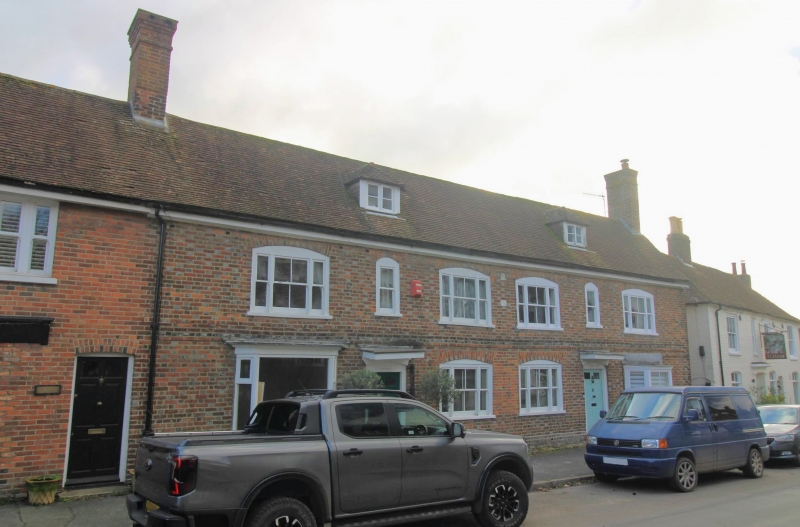
House pair. 1742. Almost chequered red and grey brick in Flemish bond. Plain tile roof. 2 storeys and attic on brick plinth. Plat band. Boxed eaves. Roof gabled to right and continuous with adjacent property to left. Brick gable-end stacks. Two small two-light dormers with hipped plain tile roofs. Regular six-window front; each house double-fronted with two tripartite sashes and central two-pane sash, all with segmental heads. Two similar tripartite sashes to centre of ground floor. Canted ground-floor bay window with flat corniced roof to outer end of each house. Door with four fielded panels, two top lights, segmental head and flat floating hood to centre of left section, to Loriners. Similar door, but with four flush panels, to centre of right section, to Trentham. Sun Insurance plaque to centre, with 1742 datestone under it. Short red and grey brick rear wing to right, set back from right gable end, with plain tile roof with lower eaves than main range. Interior not inspected.
Listing NGR: TR1768743974
External links are from the relevant listing authority and, where applicable, Wikidata. Wikidata IDs may be related buildings as well as this specific building. If you want to add or update a link, you will need to do so by editing the Wikidata entry.


Other nearby listed buildings