Latitude: 52.3987 / 52°23'55"N
Longitude: 0.2557 / 0°15'20"E
OS Eastings: 553566
OS Northings: 280249
OS Grid: TL535802
Mapcode National: GBR M6G.RF7
Mapcode Global: VHHJ6.DZ10
Plus Code: 9F4297X4+F7
Entry Name: 8-12 West End
Listing Date: 19 June 1972
Last Amended: 22 February 1973
Grade: II
Source: Historic England
Source ID: 1252361
English Heritage Legacy ID: 435367
ID on this website: 101252361
Location: Ely, East Cambridgeshire, CB6
County: Cambridgeshire
District: East Cambridgeshire
Civil Parish: Ely
Built-Up Area: Ely
Traditional County: Cambridgeshire
Lieutenancy Area (Ceremonial County): Cambridgeshire
Church of England Parish: Ely
Church of England Diocese: Ely
Tagged with: Building
This list entry was subject to a Minor Amendment on 9 September 2024 to remove superfluous amendment details, amend and reformat the text to current standards
TL 5380
4/230
WEST END
Nos 8 to 12 (even)
(Formerly listed as WATERSIDE (North Side) Nos 8 to 12 (even))
GV
II
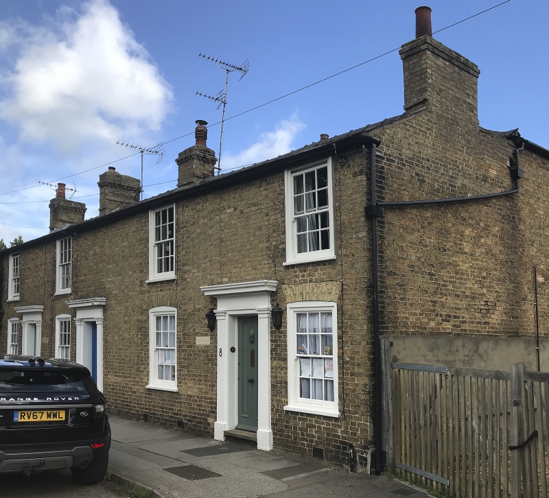
A range of three early-mid C19 brick houses (Haddenham bricks) two storeys. Four window range, double-hung sashes with glazings bars, in flush cased frames. The ground storey windows have segmental brick arched heads. The doorways have pilasted, frieze and cornice, two have original doors with vertical panels . Roofs slake.
Nos 2 to 12 (even) and No 16 (West End PH) form a group with No 1 (St John's Farmhouse) dovecote, wall and Barns to the north and south west of the farmhouse and Nos 2 to 20 (even) St John's Road.
Listing NGR: TL5356680249
External links are from the relevant listing authority and, where applicable, Wikidata. Wikidata IDs may be related buildings as well as this specific building. If you want to add or update a link, you will need to do so by editing the Wikidata entry.


Other nearby listed buildings