Latitude: 51.0661 / 51°3'57"N
Longitude: -1.7945 / 1°47'40"W
OS Eastings: 414496
OS Northings: 129659
OS Grid: SU144296
Mapcode National: GBR 51F.33S
Mapcode Global: FRA 7649.DQP
Plus Code: 9C3W3684+C6
Entry Name: 16, the Close
Listing Date: 28 February 1952
Grade: II*
Source: Historic England
Source ID: 1252131
English Heritage Legacy ID: 318980
ID on this website: 101252131
Location: The Friary, Wiltshire, SP1
County: Wiltshire
Civil Parish: Salisbury
Built-Up Area: Salisbury
Traditional County: Wiltshire
Lieutenancy Area (Ceremonial County): Wiltshire
Tagged with: Building
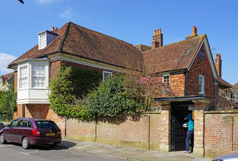
THE CLOSE 1. 1594 No 16 SU 1429 NE 4/45 28.2.52. SU 1429 NW 3/45 1I* GV 2. Irregular shaped block C16/C17 and earlier origin with rebuilding in C18 and C19. 2 storeys and attics red brick. The west wall at ground floor level has flint and stone rubble, traces of timber framing and overhang above. Hipped old tile roof. South end to North Walk has dormer window and on first floor a canted bay window sash lights, centre 4 panes wide, panelled apron, frieze and cornice, guaged triglyph ornament to frieze. The east front has coved moulded stone eaves cornice. 2 windows to both floors. mush framed sashes, glazing bars intact. Central door of 6 flush panels, rectangular fanlight with leaded radial glazing pattern. Doorcase of thin panelled pilasters, fluted consoles to cornice. Projecting gabled wing, parallel to north walk, one window facing south. Gable end tile hung with shaped tiles, 2 light leaded attic casement and sash window on ground floor. Around ground floor of this ruing a delicate wrought iron early C19 pergola, pointed arches faith delicate leaf ornament. Adjoining to north a low 2 storey red brick L plan extension with grey headers. Hipped old tile roofs, different levels. 1 small casement and sash window first floor, next to gabled wing, facing east with 2 light leaded casement on ground floor, C18/C19. South return front has semi-dormer and flush framed tripartite sash on ground floor glazing bars intact, plain door to left. Picturesque. Interior retained various fragments of timber structure: wall post and bracket in kitchen. On west side heavy chamfered tie beam and dragon beam. The porjecting gabled wing has 3 bays of trusses, windbraces partly obscured by plaster, other traces of roof structure in attics, collars and purlins. The first floor drawing room has C18 fielded pine panelling. W E Tower, Kempe's later partner lived here: various pieces of Kempe's glass also C15 quarries and coat of arms.
Nos 14, 14A, St Anne's Gate and No 15 form a very picturesque group.
Listing NGR: SU1449629661
External links are from the relevant listing authority and, where applicable, Wikidata. Wikidata IDs may be related buildings as well as this specific building. If you want to add or update a link, you will need to do so by editing the Wikidata entry.


Other nearby listed buildings