Latitude: 53.1961 / 53°11'45"N
Longitude: -1.1822 / 1°10'55"W
OS Eastings: 454730
OS Northings: 366870
OS Grid: SK547668
Mapcode National: GBR 8DM.MXS
Mapcode Global: WHDFL.TX7P
Plus Code: 9C5W5RW9+C4
Entry Name: Hall Farmhouse
Listing Date: 22 October 1986
Grade: II
Source: Historic England
Source ID: 1251906
English Heritage Legacy ID: 434794
ID on this website: 101251906
Location: Sookholme, Mansfield, Nottinghamshire, NG19
County: Nottinghamshire
District: Mansfield
Civil Parish: Warsop
Traditional County: Nottinghamshire
Lieutenancy Area (Ceremonial County): Nottinghamshire
Church of England Parish: Warsop with Sookholme
Church of England Diocese: Southwell and Nottingham
Tagged with: Farmhouse
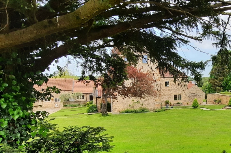
WARSOP SOOKHOLME ROAD SK 56 NW (north west side) 1/164 Hall Farmhouse G.V. II Farmhouse. c.1745. Dressed stone with hipped and gabled glazed pantile roofs with stone slate verges. Some concrete tile roofs. Dressed stone quoins. Coped gables with kneelers. 2 ridge and single gable stacks. 1/3 bays. 2 storeys. L-plan. Windows are mainly casements with flush mullions. West front has lower 2 storey service wing to left. To left, round headed door with fanlight, flanked by single casements. To its right, gabled C19 porch with coped gable and kneelers. Chamfered doorway with overlight. On each side, a casement with segmental head. To right again, a casement. Above again, off-centre datestone with segmental head inscribed 'H S E 174?'. Above, small casement with elliptical head, flanked to left by 2 and to right by single casements. North front has to left, C20 door. To its right, blocked door and beyond, mullioned casement. Above, to left, 2 casements, that to right mullioned. Rear wing has to east, a C20 casement.
Listing NGR: SK5473066870
External links are from the relevant listing authority and, where applicable, Wikidata. Wikidata IDs may be related buildings as well as this specific building. If you want to add or update a link, you will need to do so by editing the Wikidata entry.


Other nearby listed buildings