Latitude: 53.2115 / 53°12'41"N
Longitude: -1.1498 / 1°8'59"W
OS Eastings: 456873
OS Northings: 368605
OS Grid: SK568686
Mapcode National: GBR 8DG.Q3S
Mapcode Global: WHDFM.9JPW
Plus Code: 9C5W6V62+H3
Entry Name: Warsop Mill
Listing Date: 29 July 1966
Grade: II
Source: Historic England
Source ID: 1251898
English Heritage Legacy ID: 434771
ID on this website: 101251898
Location: Church Warsop, Mansfield, Nottinghamshire, NG20
County: Nottinghamshire
District: Mansfield
Civil Parish: Warsop
Built-Up Area: Market Warsop
Traditional County: Nottinghamshire
Lieutenancy Area (Ceremonial County): Nottinghamshire
Church of England Parish: Warsop with Sookholme
Church of England Diocese: Southwell and Nottingham
Tagged with: Mill
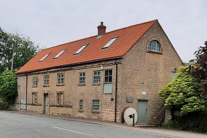
WARSOP CHURCH ROAD SK 56 NE (east side) 2/142 29.1.66 Warsop Mill G.V. II Water mill. 1767. 2 storey addition at each end, early C19. Dressed stone with asbestos cement roof. Partial string course and sill band. 2 storeys plus garrets, 6 bays. Windows are flush mullioned casements. These and door have heavy rockfaced architraves. Other windows are C19 iron casements. West front has to left, round headed wheel opening. To its right, door with datestone in lintel inscribed '1767', flanked by single casements. To right again, 2 casements and external stone stair. Above, to left, 3 mullioned casements. To their right, 2 C19 casements and a close-boarded door. South gable has to left, close boarded door with segmental head. Each gable has a semi- circular window to garret. At rear, small C19 and C20 lean-to additions. Adjoining boundary walls to north and south, dressed stone with half-round copings, have 4 C20 square piers. Approx. 45M and 30M long. Interior has mid C19 kingpost roof. Mid and late C19 roller mill and processing machinery. Early C20 water turbine.
Listing NGR: SK5687368605
External links are from the relevant listing authority and, where applicable, Wikidata. Wikidata IDs may be related buildings as well as this specific building. If you want to add or update a link, you will need to do so by editing the Wikidata entry.


Other nearby listed buildings