Latitude: 51.2297 / 51°13'47"N
Longitude: 0.5157 / 0°30'56"E
OS Eastings: 575741
OS Northings: 150846
OS Grid: TQ757508
Mapcode National: GBR PRL.Z1M
Mapcode Global: VHJML.WCH4
Plus Code: 9F326GH8+V7
Entry Name: North Lodge
Listing Date: 26 February 1987
Grade: II
Source: Historic England
Source ID: 1250222
English Heritage Legacy ID: 432501
ID on this website: 101250222
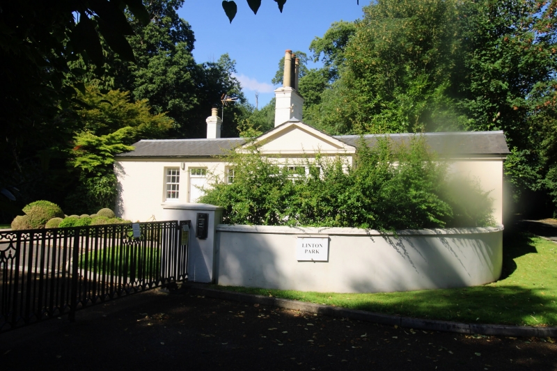
HEATH ROAD TQ 75 SE LINTON (South Side) North Lodge 3/136 II Lodge, now house. Early-to-mid C19. Stuccoed, with slate roof. Cross plan. Single storey. Pedimented gable ends to north, east and west. Panelled stuccoed stack to south of centre. Regular fenestration of one recessed 8-pane sash to each side wing, and 3 narrow round-headed lights, linked by moulded imposts and hoodmould, to north gable. Door in C20 single-storey rear extension. Formerly served Linton Park. Formerly in Loose civil parish.
Listing NGR: TQ7574150846
External links are from the relevant listing authority and, where applicable, Wikidata. Wikidata IDs may be related buildings as well as this specific building. If you want to add or update a link, you will need to do so by editing the Wikidata entry.


Other nearby listed buildings