Latitude: 51.4561 / 51°27'21"N
Longitude: -0.9576 / 0°57'27"W
OS Eastings: 472519
OS Northings: 173524
OS Grid: SU725735
Mapcode National: GBR QPF.ZH
Mapcode Global: VHDWT.CN2N
Plus Code: 9C3XF24R+CW
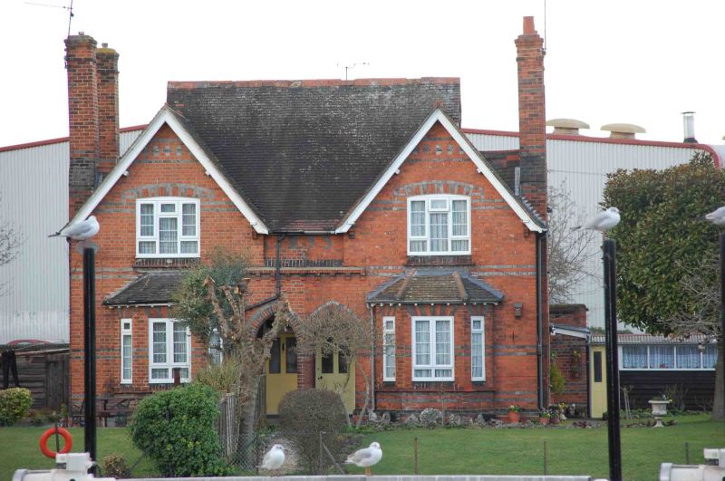
Entry Name: 47-48, Kenavon Drive
Listing Date: 10 June 1985
Grade: II
Source: Historic England
Source ID: 1248695
English Heritage Legacy ID: 39272
ID on this website: 101248695
Location: New Town, Reading, Berkshire, RG1
County: Reading
Electoral Ward/Division: Abbey
Parish: Non Civil Parish
Built-Up Area: Reading
Traditional County: Berkshire
Lieutenancy Area (Ceremonial County): Berkshire
Church of England Parish: Reading St John the Evangelist and St Stephen
Church of England Diocese: Oxford
Tagged with: Building
KENAVON DRIVE 1 5128 SU 7273 7/603 Nos 47-8 II G.V. Pair of houses. Dated 1873. Red brick, blue brick patterning, clay tile roof, red brick chimneys: Rear extension plan, lX storeys. Details similar to those of the Sewage Pumping Station buildings (q.v). Front elevation (to River Kennet) has in centre a pair of recessed porches entered via pointed archways; above these is a recessed panel bearing the date in blue brick, abovea brick corbel-table to sides, single-storied bay windows beneath 3-light windows with segmental heads, within gables with ridges lower than main roof. Pairs of chimney stacks on flank walls. Windows largely C20 metal casements. Listed for their stylistic and functional association with the sewage Pumping Station buildings.
Listing NGR: SU7251973524
External links are from the relevant listing authority and, where applicable, Wikidata. Wikidata IDs may be related buildings as well as this specific building. If you want to add or update a link, you will need to do so by editing the Wikidata entry.


Other nearby listed buildings