Latitude: 53.1076 / 53°6'27"N
Longitude: -1.5612 / 1°33'40"W
OS Eastings: 429475
OS Northings: 356807
OS Grid: SK294568
Mapcode National: GBR 599.2EG
Mapcode Global: WHCDV.Z4RY
Plus Code: 9C5W4C5Q+3G
Entry Name: The Old Village Lock Up to Rear of Number 21 Swift's Hollow
Listing Date: 23 March 1988
Grade: II
Source: Historic England
Source ID: 1248427
English Heritage Legacy ID: 429968
ID on this website: 101248427
Location: Cromford, Derbyshire Dales, Derbyshire, DE4
County: Derbyshire
District: Derbyshire Dales
Civil Parish: Cromford
Built-Up Area: Cromford
Traditional County: Derbyshire
Lieutenancy Area (Ceremonial County): Derbyshire
Church of England Parish: Cromford St Mary
Church of England Diocese: Derby
Tagged with: Architectural structure Village lock-up
CROMFORD 1390 CROMFORD HILL CROMFORD SK 2856-2956 1/78A The Old Village Lock-Up to rear of No.21 Swift's Hollow II
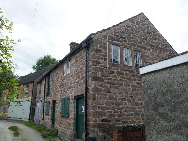
Lock-Up with keeper's accommodation above, now a garage and store. 1790. Coursed rubble with ashlar dressings. Slate roof with 2 brick stacks. 2 storey. 5 bay front. Right-hand doorway with plank door, reached up 2 steps with large square lintel. To the left a 2 light flush mullion window, and beyond another similar door and beyond again another 2 light flush mullion window. To the left an inserted pair of garage doors. Above to the right a 2 light window which has lost its flush mullion, and to the left 2 half glazed loft doors. The north-west gable front has an upper 3 light flush mullion window with its original wooden glazing bars. The interior on the ground floor contains 2 lock-up cells with iron doors.
Listing NGR: SK2947556807
External links are from the relevant listing authority and, where applicable, Wikidata. Wikidata IDs may be related buildings as well as this specific building. If you want to add or update a link, you will need to do so by editing the Wikidata entry.


Other nearby listed buildings