Latitude: 51.224 / 51°13'26"N
Longitude: 0.2145 / 0°12'52"E
OS Eastings: 554730
OS Northings: 149525
OS Grid: TQ547495
Mapcode National: GBR MNR.714
Mapcode Global: VHHPZ.NHQK
Plus Code: 9F3266F7+HQ
Entry Name: Mansers
Listing Date: 26 June 1980
Grade: II
Source: Historic England
Source ID: 1248266
English Heritage Legacy ID: 179607
ID on this website: 101248266
Location: Tonbridge and Malling, Kent, TN11
County: Kent
District: Tonbridge and Malling
Civil Parish: Hildenborough
Traditional County: Kent
Lieutenancy Area (Ceremonial County): Kent
Church of England Parish: Hildenborough St John the Evangelist
Church of England Diocese: Rochester
Tagged with: Building
HILDENBOROUGH NIZELS LANE (east side) TQ 54 NW 4/174 Mansers 26.6.80
II
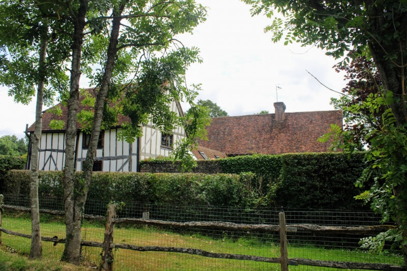
House, converted from 3 C17 and C18 farmbuildings in the 1930s by an architect called Manser (information from the owners). Framed construction with peg- tile roofs; brick stacks.
Plan and Development: 3 adjoining ranges forming an approximate overall U plan. The west and east ranges, both on a north south axis, are linked by a single-storey north range at right angles. The east range is the main part of the house and originated as a 5-bay threshing barn with opposed doors, the northern most bay either an addition or a rebuilding. The conversion involved infilling the doorways with framing and inserting a floor and stack. The 4- bay north range is said to be a former cow byre and forms an entrance hall. The west range incorporates a 1930s garage with accommodation over and may have originated as an C18 hay barn. The conversion has involved some alterations to the roof construction of the east and west ranges and the insertion of casement windows throughout.
Exterior: Exposed framing throughout on brick plinths with a set of 1930s timber casement windows of various different sizes. The north elevation is the present entrance front with the 4-bay north range in the centre flanked by the gabled end of the east range to the left and the half-hipped end of the west range to the right. 1930s plank and cover strip front door into the north range, recessed behind 1930s curving braces imitating the central bay of a Wealden House. The end of the east range has a 1930s single-storey porch addition under a 2-span roof. Pair of 1930s garage doors in the end of the west range with a segmental arched lintel. The east range (the former threshing barn) has straight tension braces above the middle rail in the bays flanking the former full-height threshing doors and retains the massive hinges from which the doors were hung. The framing of the north end bay is slightly different and it may be an addition or a rebuilding. The 1930s inserted stack re-uses old bricks in the shaft. The rear (south) elevation of the north range is 4-bays, the wall posts with concave braces, the bays perhaps originally open. There is a 1930s plank and cover strip door with a rounded head leading into the entrance hall. The 3-bay west range framing is of slender scantling with straight up braces above the middle rail.
Interior: Good quality 1930s joinery throughout the east range. An unglazed C17 or C18 window with stanchions and a pegged frame exists on the party wall between the north and east ranges; it is not necessarily in situ.
Roof: The east range has a butt purlin roof with no ridge board, with considerable repair and replacement of the timbers. Redundant mortises show that braces below the tie-beam have been removed on the west side for the insertion of a first floor axial passage. The west range has a side purlin roof.
An interesting example of a 1930s farmbuilding conversion.
Listing NGR: TQ5473049525
External links are from the relevant listing authority and, where applicable, Wikidata. Wikidata IDs may be related buildings as well as this specific building. If you want to add or update a link, you will need to do so by editing the Wikidata entry.


Other nearby listed buildings