Latitude: 53.0192 / 53°1'9"N
Longitude: -1.2703 / 1°16'13"W
OS Eastings: 449047
OS Northings: 347125
OS Grid: SK490471
Mapcode National: GBR 7F9.PNH
Mapcode Global: WHDGJ.GCBR
Plus Code: 9C5W2P9H+MV
Entry Name: Greasley Castle Farmhouse
Listing Date: 14 May 1952
Last Amended: 25 January 1989
Grade: II
Source: Historic England
Source ID: 1247955
English Heritage Legacy ID: 429410
ID on this website: 101247955
Location: Greasley, Broxtowe, Nottinghamshire, NG16
County: Nottinghamshire
District: Broxtowe
Civil Parish: Greasley
Traditional County: Nottinghamshire
Lieutenancy Area (Ceremonial County): Nottinghamshire
Church of England Parish: Greasley
Church of England Diocese: Southwell and Nottingham
Tagged with: Farmhouse
SK 44 NE GREASLEY MAIN ROAD Greasley (south west side)
2/17 Greasley Castle 14/5/52 Farmhouse
GV II
The entry shall be amended to read:-
SK 44 NE GREASLEY CHURCH ROAD Greasley (south west side)
14/5/52 No. 120,Greasley Castle Farm- GV II House
------------------------------------
SK 44 NE GREASLEY MAIN ROAD Greasley (south west side)
2/17 Greasley Castle 14.5.52 Farmhouse
G.V. II
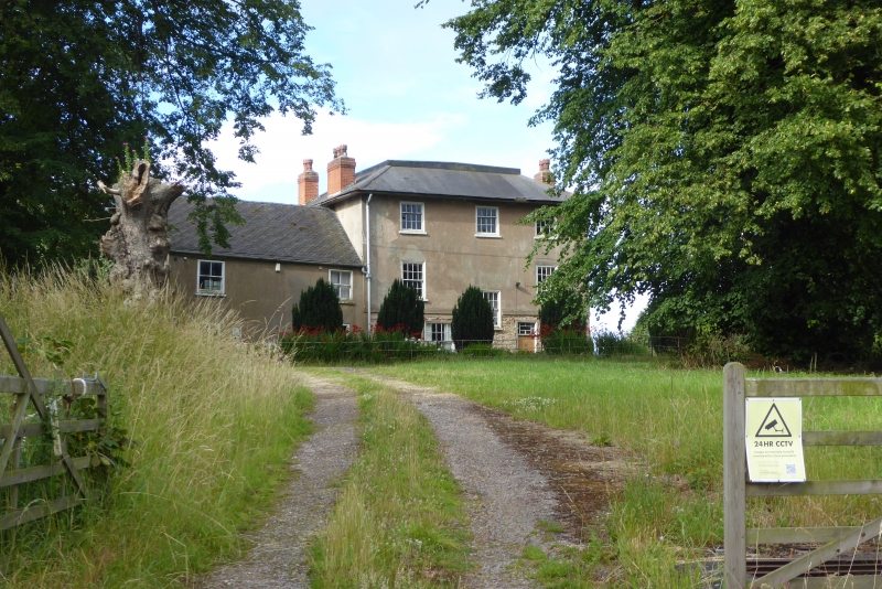
Farmhouse. c.1800 and mid C19. Brick, rendered, with plain tile and slate roofs. First floor band. 4 side wall stacks. 3 and 2 storeys, 5 bays. L-plan. Windows are mainly glazing bar sashes. North front has to left, 2 storey service wing with casement and a plain sash. To its right a sash flanked by single re-set mask stops, and beyond, stair light on higher level. To right again, door with geometrical overlight, and beyond, a round window. Above, 2 plain and 2 glazing bar sashes. Above again, 3 smaller sashes. West side has a casement and 2 small sashes. Garden front has 4 sashes and above, 2 sashes on each floor, those to second floor smaller. To right, coursed rubble boundary wall, with ramped slab coping. Service wing rear elevation has a door and 2 casements, all with segmental heads. Above, a casement and a Yorkshire sash.
Listing NGR: SK4904747125
External links are from the relevant listing authority and, where applicable, Wikidata. Wikidata IDs may be related buildings as well as this specific building. If you want to add or update a link, you will need to do so by editing the Wikidata entry.


Other nearby listed buildings