Latitude: 53.3801 / 53°22'48"N
Longitude: -1.47 / 1°28'12"W
OS Eastings: 435352
OS Northings: 387161
OS Grid: SK353871
Mapcode National: GBR 9HL.C3
Mapcode Global: WHDDP.D97K
Plus Code: 9C5W9GJH+3X
Entry Name: Boundary Wall with Standard Measures
Listing Date: 12 December 1995
Grade: II
Source: Historic England
Source ID: 1247330
English Heritage Legacy ID: 456473
ID on this website: 101247330
Location: Orchard Square, Sheffield, South Yorkshire, S1
County: Sheffield
Electoral Ward/Division: City
Parish: Non Civil Parish
Built-Up Area: Sheffield
Traditional County: Yorkshire
Lieutenancy Area (Ceremonial County): South Yorkshire
Church of England Parish: Sheffield
Church of England Diocese: Sheffield
Tagged with: Wall
SK3587SW
784-1/24/687
SHEFFIELD
ST PAUL'S PARADE
(North side)
Boundary wall with Standard Measures
GV
II
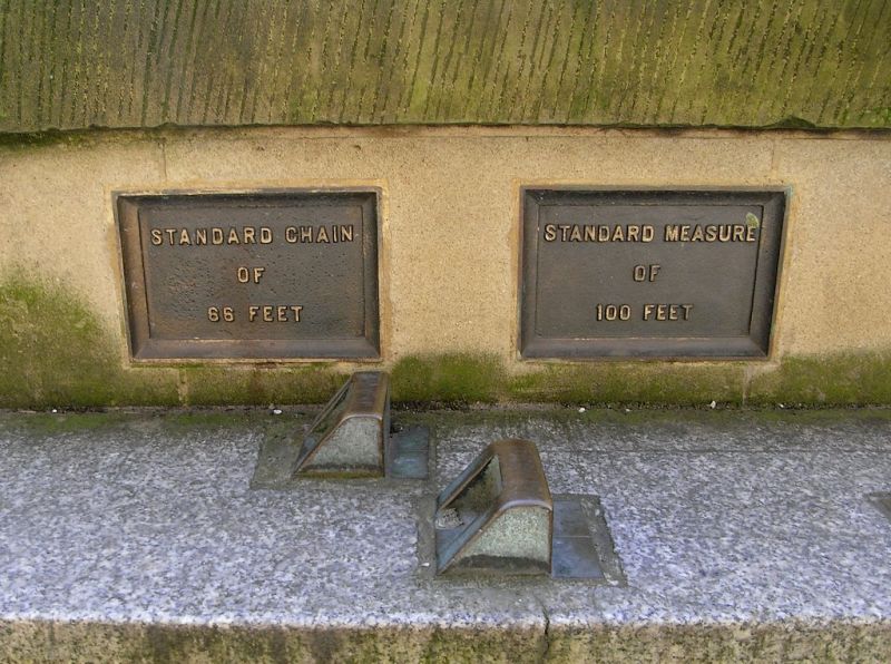
Boundary wall, incorporating a series of Imperial and Metric
standard measures. Dated 1910. Ashlar wall with stepped and
ramped chamfered coping. Off-centre flat gable with inscribed
bronze tablet and bronze measures of shorter lengths. Granite
plinth with bronze markers for the longer lengths. 100ft.
long. Erected to commemorate the meeting in Sheffield of the
British Association in September 1910.
Listing NGR: SK3535287161
External links are from the relevant listing authority and, where applicable, Wikidata. Wikidata IDs may be related buildings as well as this specific building. If you want to add or update a link, you will need to do so by editing the Wikidata entry.


Other nearby listed buildings