Latitude: 51.2668 / 51°16'0"N
Longitude: 0.0725 / 0°4'21"E
OS Eastings: 544685
OS Northings: 153998
OS Grid: TQ446539
Mapcode National: GBR LLN.F53
Mapcode Global: VHHPQ.6FP7
Plus Code: 9F32738F+P2
Entry Name: The Pheasantry
Listing Date: 10 September 1954
Grade: II
Source: Historic England
Source ID: 1244139
English Heritage Legacy ID: 448949
ID on this website: 101244139
Location: Westerham, Sevenoaks, Kent, TN16
County: Kent
District: Sevenoaks
Civil Parish: Westerham
Built-Up Area: Westerham
Traditional County: Kent
Lieutenancy Area (Ceremonial County): Kent
Church of England Parish: Westerham St Mary the Virgin
Church of England Diocese: Rochester
Tagged with: Architectural structure
1. 5280 WESTERHAM WESTERHAM Vicarage Hill (South Side)
The Pheasantry TQ 4454 35/1456 TQ 4453 36/1456 10.9.54.
II
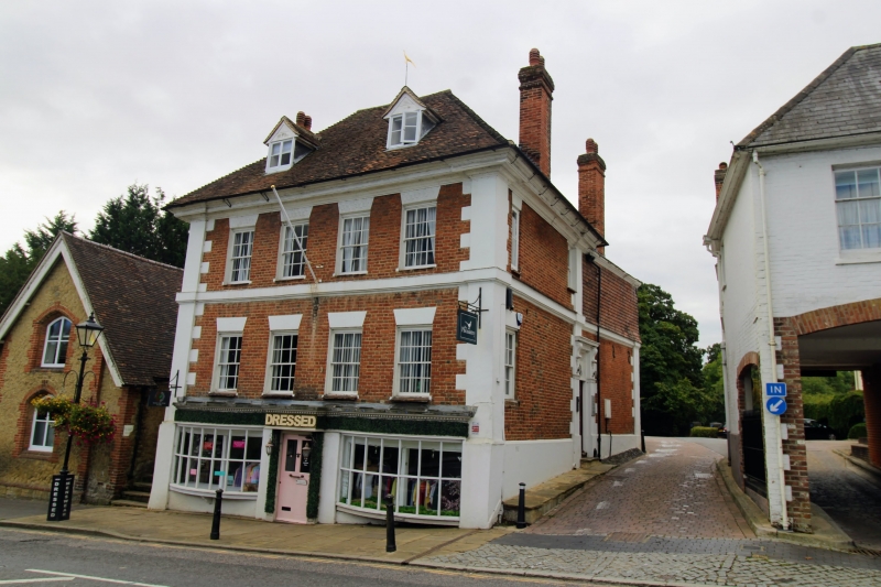
2. Circa 1700. 3 storeys and attic, 4 windows. High pitched, tiled, hipped roof with 2 gabled dormers. Stucco pilasters, with alternating block dressings, support heavy projecting moulded cornice and are broken forward to form corner capitals. Red brick front. Gauged, flat brick arches, painted white, to C19 casement windows. 2nd floor stuccoed band. Ground floor 2 renewed oak oriel bow windows and central door. Main entrance, on right return, has 6-panel door under patterned fanlight with doorcase of stucco pilasters and entablature.
Listing NGR: TQ4468553998
External links are from the relevant listing authority and, where applicable, Wikidata. Wikidata IDs may be related buildings as well as this specific building. If you want to add or update a link, you will need to do so by editing the Wikidata entry.


Other nearby listed buildings