Latitude: 51.2658 / 51°15'56"N
Longitude: 0.0684 / 0°4'6"E
OS Eastings: 544403
OS Northings: 153877
OS Grid: TQ444538
Mapcode National: GBR LLN.D5G
Mapcode Global: VHHPQ.4GJ0
Plus Code: 9F327389+89
Entry Name: 53 and 55, High Street
Listing Date: 16 January 1975
Grade: II
Source: Historic England
Source ID: 1244031
English Heritage Legacy ID: 448703
ID on this website: 101244031
Location: Westerham, Sevenoaks, Kent, TN16
County: Kent
District: Sevenoaks
Civil Parish: Westerham
Built-Up Area: Westerham
Traditional County: Kent
Lieutenancy Area (Ceremonial County): Kent
Church of England Parish: Westerham St Mary the Virgin
Church of England Diocese: Rochester
Tagged with: Building
1. 5280 WESTERHAM WESTERHAM High Street (South Side)
Nos 53 & 55 TQ 4453 36/1398
II
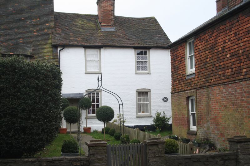
2. C18 pair, each 2 storeys, 1 window. Painted brick with painted stone plinth. Tiled roof. C18 sash windows with glazing bars in exposed frames, those on ground floor under segmental arches. No 53 has door with bracketed hood at left. No 55 has entrance on return which is brick and tile hung.
Listing NGR: TQ4440353877
External links are from the relevant listing authority and, where applicable, Wikidata. Wikidata IDs may be related buildings as well as this specific building. If you want to add or update a link, you will need to do so by editing the Wikidata entry.


Other nearby listed buildings