Latitude: 51.3643 / 51°21'51"N
Longitude: -2.0349 / 2°2'5"W
OS Eastings: 397665
OS Northings: 162806
OS Grid: ST976628
Mapcode National: GBR 2TS.GC2
Mapcode Global: VHB47.PZ20
Plus Code: 9C3V9X78+P2
Entry Name: Myrtle Farmhouse
Listing Date: 17 September 1976
Last Amended: 3 April 1987
Grade: II
Source: Historic England
Source ID: 1243401
English Heritage Legacy ID: 447204
ID on this website: 101243401
Location: Rowde, Wiltshire, SN10
County: Wiltshire
Civil Parish: Rowde
Built-Up Area: Rowde
Traditional County: Wiltshire
Lieutenancy Area (Ceremonial County): Wiltshire
Tagged with: Farmhouse
ROWDE BUNNIES LANE ST 9762 11/224 Myrtle Farmhouse (formerly listed as Cottage 17.9.76 at Myrtle Farm)
GV II
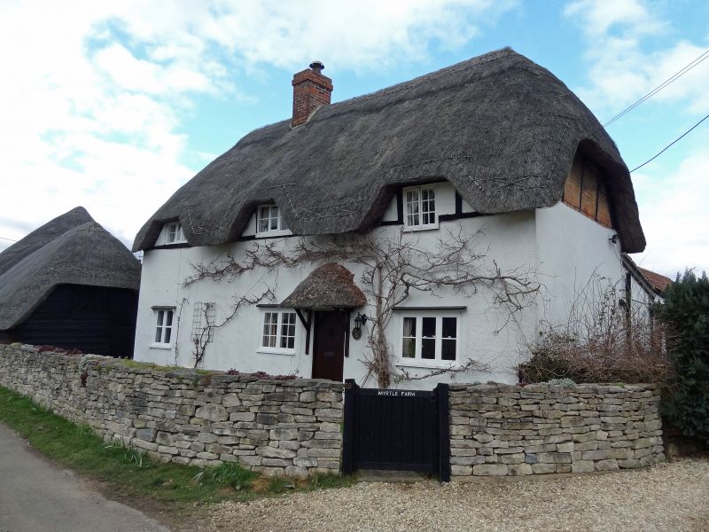
House, C17, timber-frame and roughcast with thatched half-hipped roof and ridge stack. 1 1/2 storeys, 3 window range. Three eyebrows over 2 triple casements and casement pair. Main walls are rendered with casement pair, casement pair, door and triple casement, timber pent hoods over lower windows, C20 pedimental hood over door.
Listing NGR: ST9766562806
External links are from the relevant listing authority and, where applicable, Wikidata. Wikidata IDs may be related buildings as well as this specific building. If you want to add or update a link, you will need to do so by editing the Wikidata entry.


Other nearby listed buildings