Latitude: 51.284 / 51°17'2"N
Longitude: 0.168 / 0°10'4"E
OS Eastings: 551291
OS Northings: 156104
OS Grid: TQ512561
Mapcode National: GBR S9.YWZ
Mapcode Global: VHHPK.VZPL
Plus Code: 9F3275M9+H6
Entry Name: The Old Farmhouse
Listing Date: 10 September 1954
Grade: II
Source: Historic England
Source ID: 1243291
English Heritage Legacy ID: 446978
ID on this website: 101243291
Location: Riverhead, Sevenoaks, Kent, TN13
County: Kent
District: Sevenoaks
Civil Parish: Riverhead
Built-Up Area: Sevenoaks
Traditional County: Kent
Lieutenancy Area (Ceremonial County): Kent
Church of England Parish: Riverhead St Mary
Church of England Diocese: Rochester
Tagged with: Farmhouse
1. 5280 RIVERHEAD RIVERHEAD Chipstead Lane (South Side)
The Old Farmhouse TQ 5156 25/963 lO.9.54.
II GV
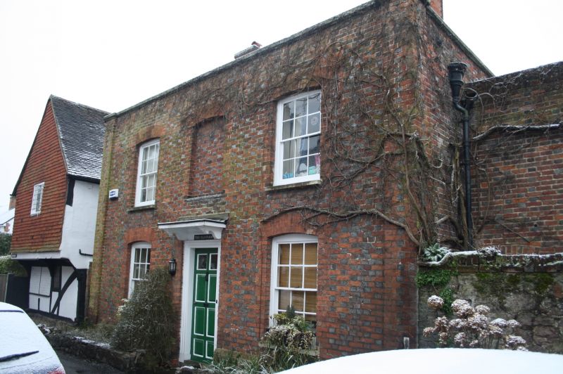
2. Early C18 front, of 2 storeys, 3 windows, on C17 timber framed range built parallel to and£against early C15 hall house. Red brick with parapet concealing high pitched tiled roofs, U-shaped to rear, with central part sweeping down to ground floor eaves level. C17 and later rear extensions. 3 gabled dormers face west. Front windows sashes with glazing bars in exposed frames under segmental brick arches. Centre panelled door in moulded architrave under flat hood on carved brackets. Inside front section 2 early C18 panelled rooms and delicate staircase of a little earlier. In old part parts of collar purlin and crown post, shorn of one brace, can be seen; also one end of main truss with heavy arched tie beam end and huge arch brace, chamfered in two places.
The Old Cottage, the Old Farm House, and the stable building form a group.
Listing NGR: TQ5129156104
External links are from the relevant listing authority and, where applicable, Wikidata. Wikidata IDs may be related buildings as well as this specific building. If you want to add or update a link, you will need to do so by editing the Wikidata entry.


Other nearby listed buildings