Latitude: 52.8389 / 52°50'19"N
Longitude: -1.1028 / 1°6'10"W
OS Eastings: 460534
OS Northings: 327194
OS Grid: SK605271
Mapcode National: GBR 9LH.402
Mapcode Global: WHFJJ.1X41
Plus Code: 9C4WRVQW+GV
Entry Name: Manor House Farmhouse
Listing Date: 12 October 1987
Grade: II
Source: Historic England
Source ID: 1242535
English Heritage Legacy ID: 441887
ID on this website: 101242535
Location: Wysall, Rushcliffe, Nottinghamshire, NG12
County: Nottinghamshire
District: Rushcliffe
Civil Parish: Wysall
Built-Up Area: Wysall
Traditional County: Nottinghamshire
Lieutenancy Area (Ceremonial County): Nottinghamshire
Church of England Parish: Wysall with Thorpe-in-the-Glebe
Church of England Diocese: Southwell and Nottingham
Tagged with: Farmhouse
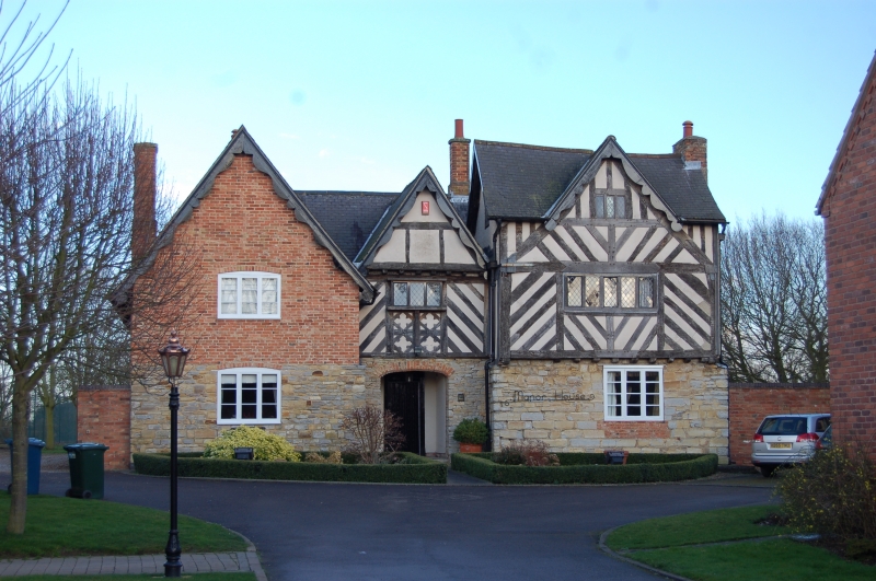
WYSALL MAIN STREET SK 62 NW (west side) 6/152 Manor House Farmhouse 5/52 II House. C16, C17, C19 alterations. Timber frame, rubble, render, red brick, some ashlar. Slate roof. Single left and right external and 2 rear red brick stacks. Gables with C19 decorative bargeboards. The right single bay on an ashlar plinth. 2 storeys, 3 bays. Right 2 bays timber framed, left single bay rubble and brick. The outer single bays project. The single left and central bays are gabled. Right single bay with first floor jetty. Central single bay with possible first floor jetty and jetty over first floor opening. Central segmental arched doorway with overlight and marginal lights leading to inner porch with inner plank and stud door with decorative overlight. To the left is a single segmental arched tripartite casement and to the right a single tripartite casement. Above is a single casement with single segmental arched tripartite casement to the left and single quadripartite casement to the right, being gabled over. Right single bay with evidence of possible herringbone framing. To the rear are red brick and slate wings on rubble plinths.
Listing NGR: SK6037227181
External links are from the relevant listing authority and, where applicable, Wikidata. Wikidata IDs may be related buildings as well as this specific building. If you want to add or update a link, you will need to do so by editing the Wikidata entry.


Other nearby listed buildings