Latitude: 53.632 / 53°37'55"N
Longitude: -2.411 / 2°24'39"W
OS Eastings: 372920
OS Northings: 415129
OS Grid: SD729151
Mapcode National: GBR CVLF.TR
Mapcode Global: WH97G.YZ21
Plus Code: 9C5VJHJQ+QJ
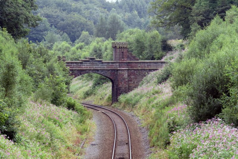
Entry Name: Bridge over Railway Circa 150 Metres South West of Turton Tower
Listing Date: 27 September 1984
Grade: II
Source: Historic England
Source ID: 1241547
English Heritage Legacy ID: 440657
ID on this website: 101241547
Location: Chapeltown, Blackburn with Darwen, Lancashire, BL7
County: Blackburn with Darwen
Civil Parish: North Turton
Traditional County: Lancashire
Lieutenancy Area (Ceremonial County): Lancashire
Church of England Parish: Turton St Anne
Church of England Diocese: Manchester
Tagged with: Road bridge
SD 71 NW TURTON
SD 729 151
7/79 Bridge over railway c.150 metres south west of Turton Tower - GV II
Bridge across railway cutting for Blackburn, Darwen and Bolton Railway, 1847-8. Resident Engineer, Terence Flanagan. Rock-faced and ashlared gritstone. Medieval style: 4-centred arch with piers to the walls at the west end carried above the parapet in ashlar as rectangular machicolated turrets, that on the south side with a viewing deck approached by steps protected by a stepped parapet. Ashlar parapets, stepped above the centre of the arch, are pierced by cross-shaped arrow slits, terminate with polygonal pseudo- turrets to the outer faces, and each has another pseudo-turret corbelled on the outer face with its machicolated cap resting on the coping. This bridge is the more elaborate of a pair of bridges built under the terms of agreement with James Kay of Turton Tower (q.v.) who was a director of the Blackburn, Darwen and Bolton Railway Company.
Listing NGR: SD7292015129
External links are from the relevant listing authority and, where applicable, Wikidata. Wikidata IDs may be related buildings as well as this specific building. If you want to add or update a link, you will need to do so by editing the Wikidata entry.


Other nearby listed buildings