Latitude: 53.8371 / 53°50'13"N
Longitude: -1.6439 / 1°38'37"W
OS Eastings: 423533
OS Northings: 437930
OS Grid: SE235379
Mapcode National: GBR JSY2.X7
Mapcode Global: WHC94.QTD8
Plus Code: 9C5WR9P4+RF
Entry Name: 4, Hall Lane
Listing Date: 7 April 1988
Grade: II
Source: Historic England
Source ID: 1239996
English Heritage Legacy ID: 436587
ID on this website: 101239996
Location: Horsforth, Leeds, West Yorkshire, LS18
County: Leeds
Civil Parish: Horsforth
Built-Up Area: Horsforth
Traditional County: Yorkshire
Lieutenancy Area (Ceremonial County): West Yorkshire
Church of England Parish: Horsforth St Margaret
Church of England Diocese: Leeds
Tagged with: Building
HORSFORTH HALL LANE SE 23 NW LS 18 (north side) 8/129 No. 4 - GV II
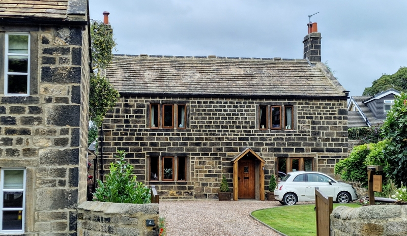
Farmhouse, now house. Mid to later C18, altered. Coursed squared sandstone with quoins, stone slate roof. Double-depth 2-unit plan. Two storeys and 2 bays, almost symmetrical; offset right of centre a doorway with plain surround (lintel renewed), and to left of this a vertical joint and patched masonry suggesting position of a former 2nd doorway; two 3-light windows on each floor, all with flat-faced slightly-recessed mullions and plain surrounds (those to right not vertically aligned). Gable chimneys, gable copings with kneelers. Item is set back from road, but forms group with No. 6.
Listing NGR: SE2353337930
External links are from the relevant listing authority and, where applicable, Wikidata. Wikidata IDs may be related buildings as well as this specific building. If you want to add or update a link, you will need to do so by editing the Wikidata entry.


Other nearby listed buildings