Latitude: 53.3931 / 53°23'35"N
Longitude: -1.0181 / 1°1'5"W
OS Eastings: 465395
OS Northings: 388928
OS Grid: SK653889
Mapcode National: GBR PYB6.DC
Mapcode Global: WHFFV.BZF3
Plus Code: 9C5W9XVJ+7Q
Entry Name: Scrooby Top Farmhouse Restaurant
Listing Date: 1 February 1967
Last Amended: 27 November 1984
Grade: II
Source: Historic England
Source ID: 1239681
English Heritage Legacy ID: 417317
ID on this website: 101239681
Location: Scrooby Top, Bassetlaw, Nottinghamshire, DN10
County: Nottinghamshire
District: Bassetlaw
Civil Parish: Scrooby
Traditional County: Nottinghamshire
Lieutenancy Area (Ceremonial County): Nottinghamshire
Church of England Parish: Scrooby with Ranskill
Church of England Diocese: Southwell and Nottingham
Tagged with: Farmhouse
SK 68 SE SCROOBY GREAT NORTH ROAD (west side)
3/117 Scrooby Top Farmhouse 1.2.67 Restaurant. (Formerly listed as Scrooby Top House).
G.V. II
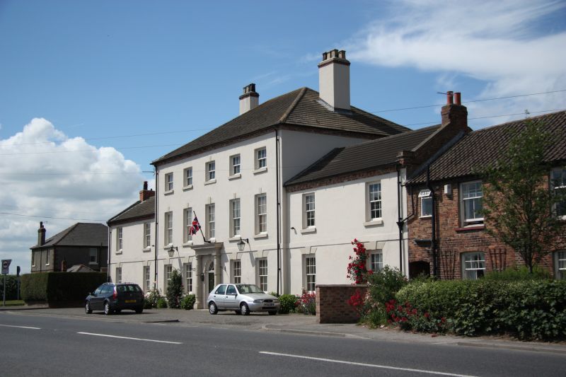
Restaurant and house, formerly a staging-post on the Great North Road. Early C18. Rendered red brick with an ashlar plinth. Hipped concrete pantile roof with 2 rendered brick gable stacks. 2.1/2 storeys 5 bays, flanked by slightly recessed 2 storey, 2 bay rendered wings with concrete pantiles to the left wing and slates to the right. Both have ashlar coped gables and single brick gable stacks. Ground floor sill and 1st floor bands extending to the flanking wings. Central doorway, panelled door with traceried fanlight, keystone and surround of attached Doric columns and entablature. Either side are 2 glazing bar sashes with keystones, with 5 similar sashes and keystones above and 5 similar, smaller, sashes on the top floor. The left wing has 2 glazing bar sashes with keystones, with 2 similar sashes above. The right wing has a single glazing bar sash with keystone, to the right is a blocked window with keystone with 2 blocked openings above, that on the left now containing a wooden slatted opening.
Listing NGR: SK6539588928
External links are from the relevant listing authority and, where applicable, Wikidata. Wikidata IDs may be related buildings as well as this specific building. If you want to add or update a link, you will need to do so by editing the Wikidata entry.


Other nearby listed buildings