Latitude: 51.36 / 51°21'36"N
Longitude: 1.4333 / 1°25'59"E
OS Eastings: 639115
OS Northings: 167924
OS Grid: TR391679
Mapcode National: GBR X07.P60
Mapcode Global: VHMCW.S2LR
Plus Code: 9F339C6M+28
Entry Name: Crampton Tower
Listing Date: 20 September 1974
Grade: II
Source: Historic England
Source ID: 1239630
English Heritage Legacy ID: 417601
ID on this website: 101239630
Location: Broadstairs, Thanet, Kent, CT10
County: Kent
District: Thanet
Civil Parish: Broadstairs and St. Peters
Built-Up Area: Broadstairs
Traditional County: Kent
Lieutenancy Area (Ceremonial County): Kent
Tagged with: Museum Water tower
HIGH STREET 1. 5283 (South Side) BROADSTAIRS Crampton Tower TR 3967 NE 5/110 II
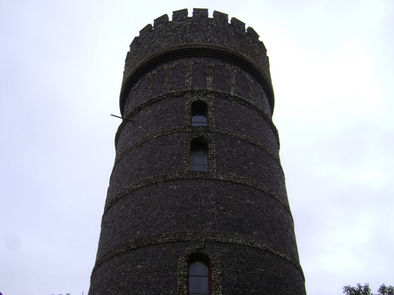
2. A water tower dated 1859. A circular tower, 3 storeys high faced with flint and having rough flint dressings and stringcourses. Crenellated parapet. Brick moulded cornice and band of blank arcading picked out in rough flints with blank panels of knapped flint between. Round-headed windows.
Listing NGR: TR3941667835
External links are from the relevant listing authority and, where applicable, Wikidata. Wikidata IDs may be related buildings as well as this specific building. If you want to add or update a link, you will need to do so by editing the Wikidata entry.


Other nearby listed buildings