Latitude: 51.6467 / 51°38'48"N
Longitude: -0.6318 / 0°37'54"W
OS Eastings: 494760
OS Northings: 195102
OS Grid: SU947951
Mapcode National: GBR F6F.P2X
Mapcode Global: VHFSH.0VBZ
Plus Code: 9C3XJ9W9+M7
Entry Name: Stonypath Cottage and Parkend Cottage
Listing Date: 17 May 1984
Grade: II
Source: Historic England
Source ID: 1239363
English Heritage Legacy ID: 417219
ID on this website: 101239363
Location: Coleshill, Buckinghamshire, HP7
County: Buckinghamshire
Civil Parish: Coleshill
Built-Up Area: Coleshill
Traditional County: Buckinghamshire
Lieutenancy Area (Ceremonial County): Buckinghamshire
Church of England Parish: Amersham with Coleshill
Church of England Diocese: Oxford
Tagged with: Cottage
1.
5134
SU 9495-9595
13/23
COLESHILL
VILLAGE ROAD
(west side)
Stonypath Cottage and Parkend Cottage
II
GV
2.
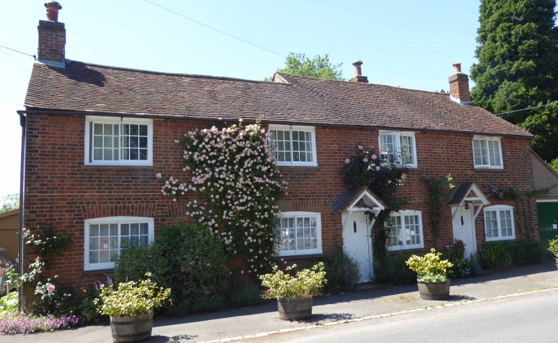
Early C19, red brick, old tile roof. Four horizontal sliding sashes under flat
brick arches with cambered soffits to each floor, two doors and one blocked door
on left with similar arches. Small modern gabled canopy to left hand door.
Group value with church.
Listing NGR: SU9476095102
External links are from the relevant listing authority and, where applicable, Wikidata. Wikidata IDs may be related buildings as well as this specific building. If you want to add or update a link, you will need to do so by editing the Wikidata entry.


Other nearby listed buildings