Latitude: 52.5634 / 52°33'48"N
Longitude: -0.7091 / 0°42'32"W
OS Eastings: 487604
OS Northings: 296960
OS Grid: SP876969
Mapcode National: GBR CSZ.7JW
Mapcode Global: WHGM6.2TMP
Plus Code: 9C4XH77R+99
Entry Name: The Hermytage
Listing Date: 10 November 1955
Grade: II
Source: Historic England
Source ID: 1236659
English Heritage Legacy ID: 427722
ID on this website: 101236659
Location: Lyddington, Rutland, LE15
County: Rutland
Civil Parish: Lyddington
Built-Up Area: Lyddington
Traditional County: Rutland
Lieutenancy Area (Ceremonial County): Rutland
Church of England Parish: Lyddington St Andrew
Church of England Diocese: Peterborough
Tagged with: Architectural structure
LYDDINGTON CHURCH LANE SP 8696-8796 9/61 10.11.55 No 6 (The Hermytage). GV II
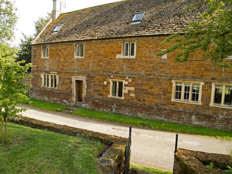
House. Dated RES 1668 on tablet. C19 extension to right. Dressed ironstone with pale limestone dressings and Collyweston slate roof. 3 ashlar chimneys with pairs of square shafts linked by moulded neckings and cornices, one to each gable end, one to right of centre. 2 storeys and attic, 4 bays. Chamfered plinth, moulded first floor string, moulded eaves. Stone gable copings with moulded kneelers. Ovolo-moulded mullion windows with leaded lights, 2-light to first floor, 4-light to ground floor left, 3 2-light and one 3-light to ground floor right. C20 door in second bay, with shouldered architrave surround. C19 bay to right has slate roof with coped gable and brick chimney, 3-light window with cambered pale limestone head to ground floor, and 2-light wooden casement to upper floor. Interior: moulded stone fireplace with 4-centred arch and cornice in left room.
Listing NGR: SP8760496960
External links are from the relevant listing authority and, where applicable, Wikidata. Wikidata IDs may be related buildings as well as this specific building. If you want to add or update a link, you will need to do so by editing the Wikidata entry.


Other nearby listed buildings