Latitude: 51.3087 / 51°18'31"N
Longitude: 0.3126 / 0°18'45"E
OS Eastings: 561283
OS Northings: 159159
OS Grid: TQ612591
Mapcode National: GBR Y9.CH7
Mapcode Global: VHHPN.CCLL
Plus Code: 9F328857+F2
Entry Name: The Old Palace
Listing Date: 1 August 1952
Last Amended: 30 May 1984
Grade: II*
Source: Historic England
Source ID: 1236308
English Heritage Legacy ID: 427266
ID on this website: 101236308
Location: Wrotham, Tonbridge and Malling, Kent, TN15
County: Kent
District: Tonbridge and Malling
Civil Parish: Wrotham
Built-Up Area: Wrotham
Traditional County: Kent
Lieutenancy Area (Ceremonial County): Kent
Church of England Parish: Wrotham St George
Church of England Diocese: Rochester
Tagged with: Architectural structure
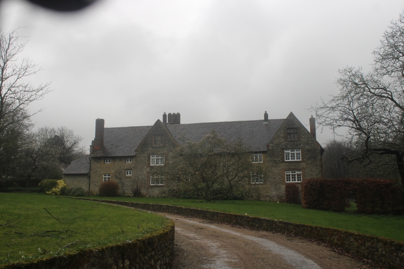
TQ6059-6159 WROTHAM C.P. BULL LANE 7/34 1.8.52 The Old Palace (formerly Listed as Remains of Archbishop's Palace)
II*
House, possibly the former kitchen wing if the long-demolished Archbishop's Palace. C16, incorporating parts of pre-1340 date. Coursed ragstone on wide ragstone plinth. Some windows with early C16 red brick dressings, some replaced by stone dressings. Plain tiled roof with return gable off-centre to left. End stack at right, off-ridge stack behind gable with coupled octagonal stacks, probably C16, and slope stack at left end. 2 storeys and attics; irregular fenestration. 1 window on each floor under gable, 2 windows on both floors to left, I window on both floors at extreme right-hand end. Square-headed doorway, with doubled glazed doors, on ground-floor to right of gable. At right-hand end is a 2-storey ruin with 1 blocked window on each floor facing south, the whole obviously originally taller. Blocked window of early C13 character behind. The palace was used by the Archbishops of Canterbury as a resting-place on the way to London, but it was demolished and used as a granary in the building of Maidstone palace. Ruins restored as a manor house by the Byng family during the C16. See J Newman, The Buildings of England: West Kent and the Weald, 1969, p.592.
Listing NGR: TQ6128259156
External links are from the relevant listing authority and, where applicable, Wikidata. Wikidata IDs may be related buildings as well as this specific building. If you want to add or update a link, you will need to do so by editing the Wikidata entry.


Other nearby listed buildings