Latitude: 51.5056 / 51°30'20"N
Longitude: -0.1403 / 0°8'25"W
OS Eastings: 529162
OS Northings: 180159
OS Grid: TQ291801
Mapcode National: GBR DG.NG
Mapcode Global: VHGQZ.JF54
Plus Code: 9C3XGV45+6V
Entry Name: 15, St James's Place
Listing Date: 24 February 1958
Grade: II
Source: Historic England
Source ID: 1235711
English Heritage Legacy ID: 426520
ID on this website: 101235711
Location: St James's, Westminster, London, SW1A
County: London
District: City of Westminster
Electoral Ward/Division: St James's
Parish: Non Civil Parish
Built-Up Area: City of Westminster
Traditional County: Middlesex
Lieutenancy Area (Ceremonial County): Greater London
Church of England Parish: St James Piccadilly
Church of England Diocese: London
Tagged with: Building
This list entry was subject to a Minor Enhancement on 19 March 2025 to amend the description and reformat the text to current standards.
TQ 2980 SW
81/84
CITY OF WESTMINSTER
ST JAMES'S PLACE SWl
No 15
24.2.58
GV
II
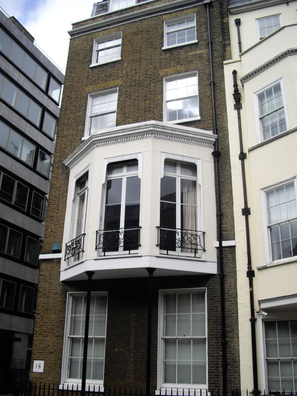
End of terrace house. c.1780-90. Brown brick, slate roof. Four storeys, basement and dormered mansard. Two windows front and seven windows flank with entrance. Two window front has revealed sash windows, no glazing bars, under flat gauged arches and stuccoed canted bay to first floor with early to mid C19 casements, supported on cast iron columns, and finished off with dentil cornice. Stone cornice below parapet with coping. Cast iron area railings. The flank has revealed sashes and some blind windows. Off-centre semicircular arched doorway with fanlight.
Interior has some panelling and dog leg staircase, late C18 cornice, etc.
There is a wall-mounted Windsor gas lantern above the northernmost ground-floor window of the west elevation.
Listing NGR: TQ2916180162
External links are from the relevant listing authority and, where applicable, Wikidata. Wikidata IDs may be related buildings as well as this specific building. If you want to add or update a link, you will need to do so by editing the Wikidata entry.


Other nearby listed buildings