Latitude: 51.0712 / 51°4'16"N
Longitude: -2.8109 / 2°48'39"W
OS Eastings: 343282
OS Northings: 130517
OS Grid: ST432305
Mapcode National: GBR MF.DX96
Mapcode Global: FRA 5609.0RQ
Plus Code: 9C3V35CQ+FJ
Entry Name: Stembridge Mill
Listing Date: 7 February 1986
Grade: II*
Source: Historic England
Source ID: 1235260
English Heritage Legacy ID: 263124
ID on this website: 101235260
Location: Stout, Somerset, TA10
County: Somerset
District: South Somerset
Civil Parish: High Ham
Traditional County: Somerset
Lieutenancy Area (Ceremonial County): Somerset
Tagged with: Mill Tower mill Thatched building
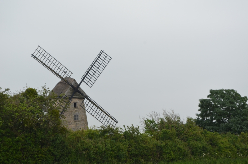
HIGH HAM CP WINDMILL ROAD (South side) ST43SW EAST FIELD 2/59 Stembridge Mill - II* -
Windmill. 1822. Local lias stone roughly coursed; shaped thatched roof with plain gable over weatherboarded superstructure; wood sail frames. Circular plan. On north side, boarded door in heavy frame, up 4 steps, with a lower door in east face and a smaller door on south face; small casement windows on east side. Former bakery building to rear. Inside, four floors, and incomplete gear which once drove two pairs of stones: fireplace in lowest floor, the flue carried in wall to an outlet just below the cap. The mill stopped working by wind in 1897, and steam power was introduced; the drive shaft and gears are still in place; the French stones have balance weight pockets let into plaster backs, patented by Clark and Dunham in 1859. On the meal floor, below the stone floor, is a wire machine for dressing flour. The only surviving windmill in Somerset, it is the only thatched mill left in England. Acquired by National Trust in 1969, partly restored by them, further work in hand October 1984 (Watts, M: Somerset Windmills, Agraphicus, 1975; Couthard A J and Watts M, Windmills of Somerset and the men who worked them, - 1978).
Listing NGR: ST4328230517
External links are from the relevant listing authority and, where applicable, Wikidata. Wikidata IDs may be related buildings as well as this specific building. If you want to add or update a link, you will need to do so by editing the Wikidata entry.


Other nearby listed buildings