Latitude: 51.1211 / 51°7'16"N
Longitude: 0.9319 / 0°55'54"E
OS Eastings: 605278
OS Northings: 139848
OS Grid: TR052398
Mapcode National: GBR SYH.NFH
Mapcode Global: VHKKW.32JW
Plus Code: 9F324WCJ+FQ
Entry Name: 16 and 16A, the Street
Listing Date: 16 February 1989
Grade: II
Source: Historic England
Source ID: 1234077
English Heritage Legacy ID: 409684
ID on this website: 101234077
Location: Mersham, Ashford, Kent, TN25
County: Kent
District: Ashford
Civil Parish: Mersham
Built-Up Area: Mersham
Traditional County: Kent
Lieutenancy Area (Ceremonial County): Kent
Tagged with: Building
TR 03 NE MERSHAM THE STREET (west side)
7/166 Nos. 16 & 16A
GV II
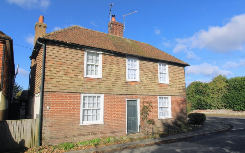
House, now house pair. Circa 1800. Red brick and tile hung on 1st floor with plain tiled and slated roofs. Two parallel ranges. Two storeys to hipped tiled roof. Regular fenestration of 3 glazing bar sashes on 1st floor and 2 on ground floor with central door of 6 panels. Canted multi-paned bay to right return. Single storey brick and weatherboarded extension to right with corrugated iron roof and boarded door leading to 16A.
Listing NGR: TR0527839848
External links are from the relevant listing authority and, where applicable, Wikidata. Wikidata IDs may be related buildings as well as this specific building. If you want to add or update a link, you will need to do so by editing the Wikidata entry.


Other nearby listed buildings