Latitude: 51.0175 / 51°1'3"N
Longitude: -3.104 / 3°6'14"W
OS Eastings: 322656
OS Northings: 124818
OS Grid: ST226248
Mapcode National: GBR M1.J1G7
Mapcode Global: FRA 46DF.6K7
Plus Code: 9C3R2V9W+29
Entry Name: Tone Bridge
Listing Date: 4 July 1975
Grade: II
Source: Historic England
Source ID: 1234029
English Heritage Legacy ID: 269920
ID on this website: 101234029
Location: North Town, Somerset, TA1
County: Somerset
District: Somerset West and Taunton
Electoral Ward/Division: Taunton Manor and Wilton
Parish: Taunton
Built-Up Area: Taunton
Traditional County: Somerset
Lieutenancy Area (Ceremonial County): Somerset
Tagged with: Bridge
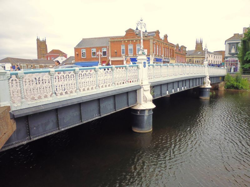
1. TONE BRIDGE 5365 Tone Bridge ST 2724 NE 9/393 II GV 2. Large girder bridge built 1895 to the designs of J H Smith and carrying the main road north over the River Tone. Slightly curved roadway constructed of large girders supported by 2 rows of circular columns with weatherings. On the outer side these columns support piers with large volutes and shields containing the Taunton Borough's coat of arms. The piers are surmounted by 4 good double lamp standards with entwined dolphins and scallop shells at bases, scrolled foliage to globe brackets and finials. These globe lamps are said to be part of the earliest electric street lighting installed in a town in Britian. (see under the Parade). Good ironwork handrails flank roadway, turned balusters with crocket capitals and openwork panels comparable to the Vivary Park gates.
Tone Bridge and Nos 5 to 9 (odd) The Bridge (West Side) form a group.
Listing NGR: ST2265624818
External links are from the relevant listing authority and, where applicable, Wikidata. Wikidata IDs may be related buildings as well as this specific building. If you want to add or update a link, you will need to do so by editing the Wikidata entry.


Other nearby listed buildings