Latitude: 51.5253 / 51°31'31"N
Longitude: -2.2771 / 2°16'37"W
OS Eastings: 380873
OS Northings: 180746
OS Grid: ST808807
Mapcode National: GBR 0NW.73Z
Mapcode Global: VH95W.HX1L
Plus Code: 9C3VGPGF+45
Entry Name: School House and Attached School Room the School House and School Room
Listing Date: 10 November 1983
Grade: II
Source: Historic England
Source ID: 1232466
English Heritage Legacy ID: 407849
ID on this website: 101232466
Location: Acton Turville, South Gloucestershire, GL9
County: South Gloucestershire
Civil Parish: Acton Turville
Built-Up Area: Acton Turville
Traditional County: Gloucestershire
Lieutenancy Area (Ceremonial County): Gloucestershire
Church of England Parish: Acton Turville
Church of England Diocese: Gloucester
Tagged with: School building
ACTON TURVILLE C.P. THE STREET ST 88 SW (south side) 7/7 School House and attached school room
G.V. II
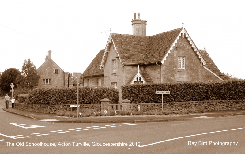
School house and school room, now a house. Dated '1862' on west gable, for the Beaufort Estate. Coursed squared rubble with freestone dressings; Cotswold stone slate roof with overhanging eaves; central moulded stack. Single storey school room to left: 3-light cross windows with diamond glazing pattern. 1 1/2 storey school house to right: projecting gabled wing with decorative bargeboards; one bay to each elevation, 2- and 3-light casement windows with diamond glazing pattern; gabled porch in re-entrant angle, plank door in chamfered surround with segmented head. Shield in west gable with 'AD/1862'; coronet over 'B' (Beaufort) in north gable.
Listing NGR: ST8087380746
External links are from the relevant listing authority and, where applicable, Wikidata. Wikidata IDs may be related buildings as well as this specific building. If you want to add or update a link, you will need to do so by editing the Wikidata entry.


Other nearby listed buildings