Latitude: 50.9913 / 50°59'28"N
Longitude: -1.5005 / 1°30'1"W
OS Eastings: 435152
OS Northings: 121442
OS Grid: SU351214
Mapcode National: GBR 757.ZBB
Mapcode Global: FRA 76RH.F7P
Plus Code: 9C2WXFRX+GQ
Entry Name: Star Inn
Listing Date: 28 August 1951
Grade: II
Source: Historic England
Source ID: 1231947
English Heritage Legacy ID: 407247
Also known as: The Star Inn, Romsey
ID on this website: 101231947
Location: Romsey, Test Valley, Hampshire, SO51
County: Hampshire
District: Test Valley
Civil Parish: Romsey
Built-Up Area: Romsey
Traditional County: Hampshire
Lieutenancy Area (Ceremonial County): Hampshire
Church of England Parish: Romsey St Mary and St Ethelflaeda
Church of England Diocese: Winchester
This list entry was subject to a Minor Amendment on 5 March 2026 to amend the name and address and reformat the text to current standards
SU 3521
3/35
HORSEFAIR (north side)
No 13, The Horsefair Pub and Rooms
(Formerly listed as No 13 (Star Inn))
28.8.51.
GV
II
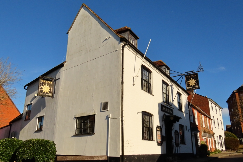
C18. Two storeys and attic. Painted brick with toothed brick eaves cornice. Old tile roof. two hipped dormers. Three sash windows on first floor; centre window three panes wide. Two similar sash windows on ground floor. Glazing bars all intact. Six flush panel central door with architrave frame and thin flat hood on bold double scroll brackets over, approached by three steps with wrought iron rails and twisted standard. Modern wrought iron sign bracket of good design to right of centre; modern enamelled sign.
Nos 5 to 13 (odd) and Rydal House form a group with Nos 37 & 39 Church Street.
Listing NGR: SU3515021448
External links are from the relevant listing authority and, where applicable, Wikidata. Wikidata IDs may be related buildings as well as this specific building. If you want to add or update a link, you will need to do so by editing the Wikidata entry.


Other nearby listed buildings